 My Dream Peaks
Day 7 · Tuesday 10 November 2026
Huts and camps get pages, routes become the way up, and summit certificates
Huts, camps and trailheads get their own pages, routes show where they start and where you sleep, and every GPS climb can become a summit certificate.
A summit is only half the story. Before it come the trailhead, the hut, the base camp and the high camp, and on day 7 we taught My Dream Peaks about all of them: places got pages of their own, routes learned where they start and where you sleep, and a GPS climb could be turned into a picture worth posting.
Huts, camps and trailheads get pages
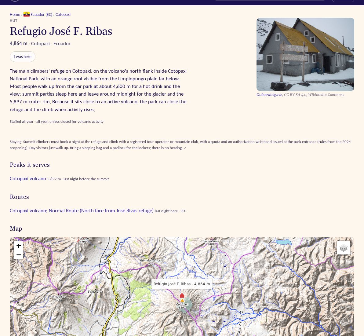
We loaded huts, refuges, shelters, bivouacs, base camps, high camps and trailheads from Wikidata and Camptocamp and merged the two where they describe the same place. Every place now has a page: the peaks it serves (and how: routes start here, last night before the summit, on the way up, or a distance away), the routes that start or sleep there, a map, nearby places and the sources. Positions we only know roughly are marked as approximate, and pages show whether a hut is staffed and in which season. Later in the day place pages also listed the treks that start, pass or end there, with the whole chain of stops.
Routes as the way up
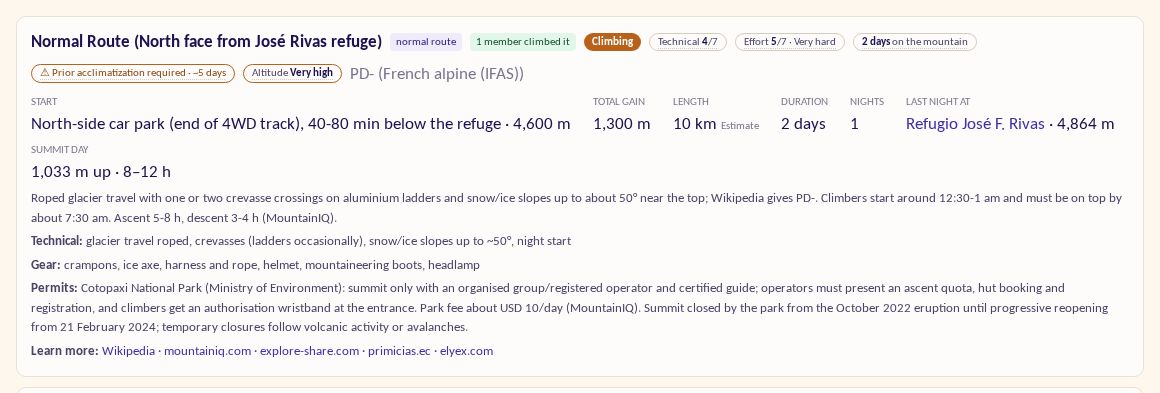
Peak pages now list their huts and camps, and a route's start and last overnight link straight to the place. On Cotopaxi's normal route you can click through to Refugio José F. Ribas at 4,864 m, the last night before the summit. Behind it is a new idea, chains of stops for treks and climbs: Everest is the EBC trek plus the climb from Base Camp, Everest and Lhotse share that same Base Camp, and a traverse comes down another way, shown as "Down by" on the route.
Summit certificates
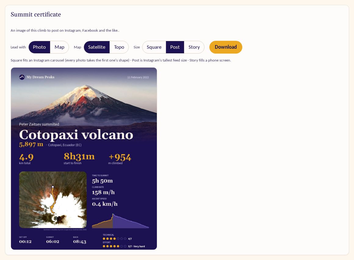
Every GPS climb can now become a summit certificate to post on Instagram, Facebook and the like. Three independent choices: lead with your photo or with the map, pick a satellite map (USGS in the US, EOX elsewhere) or a topo one, and choose square, post or story size. Square exists because Instagram crops every photo in a carousel to the shape of the first. The certificate shows your name, the peak, the numbers, the route and the elevation profile, never your heart rate or notes.
Search finds people
Search now finds people as well as peaks: climbers from the people directory and public members, on the results page and in the suggestions as you type.
Also
- Share images for lists: a list's five tallest peaks, or a member's progress with a dot per peak.
- Members follow a club's own list, starred automatically after a summit or attempt.
- Mountains with several summits (Pichincha: Guagua and Rucu; the Illinizas: Sur and Norte) send each climb to the summit actually reached; Illiniza Norte (5,126 m) was added.
- A first trial of trips, for Peter only: days grouped from tracks, places reached, and a day-by-day view.