 My Dream Peaks
Hut
Refuge de Nant Borrant
1,459 m · Haute-Savoie · France
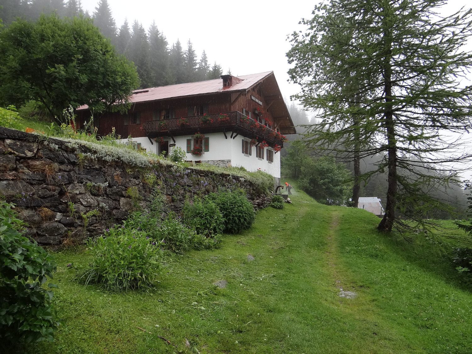
A small, privately run hut in an old wooden mountain chalet at the head of the Val Montjoie above Les Contamines-Montjoie, on a pasture beside the Bon Nant torrent (called the Nant Borrant up here). It lies on the Tour du Mont Blanc and the GR5 a short walk above Notre-Dame de la Gorge, and makes a quieter first or last night than the busier huts higher up towards the Col du Bonhomme. Many walkers also stop just for lunch on its terrace.
Staffed in season · early June to late September (2027: 2 June – 26 September); no winter room · 37 beds
History and people
Run by Privately run (family-managed refuge listed on the official Tour du Mont Blanc booking site).
- 1976 The chalet, dating from the 1800s and until then run as a mountain hotel, became a walkers' refuge as the Tour du Mont Blanc grew busier. ↗
Good to know
- Nant Borrant is the local name of the upper Bon Nant, the torrent that rises under the Col du Bonhomme and flows down the Val Montjoie. ↗
- The usual path up from Notre-Dame de la Gorge follows an old paved track known as the Roman road. ↗
- There is free camping about 10 minutes from the hut, and two drinking-water fountains (Sollié and La Laya) within 500 m. ↗
Getting there and climbing from here
- From Notre-Dame de la Gorge (1,190 m, end of the road above Les Contamines) · Tour du Mont Blanc / GR5 up the old Roman road through the forest · about 0.75 h, +270 m
- From Les Chapieux · Tour du Mont Blanc in reverse, over the Col de la Croix du Bonhomme and Col du Bonhomme, down past Refuge de la Balme
Staying: Online through the official Tour du Mont Blanc booking site, or by phone/email to the hut. Half board in small dormitories of 6–9 beds with duvets; hot showers; dinner at 19:00. Lunch, snacks and drinks served all day. ↗
Peaks it serves
- Mont Tondu 3,196 m · 3.6 km away
- Aiguilles de la Penaz 2,688 m · 3.9 km away
- Tête de la Cicle 2,552 m · 3.4 km away
- Aiguille Croche 2,487 m · 4.9 km away
- Col du Bonhomme 2,329 m · 4.9 km away
Treks
Tour du Mont Blanc, anticlockwise from Les Houches stop 4 of 31
Les Houches → Les Contamines-Montjoie → Notre-Dame de la Gorge → Refuge de Nant Borrant → Refuge de la Balme → Refuge de la Croix du Bonhomme → Les Chapieux → La Ville des Glaciers → Refuge des Mottets → Rifugio Elisabetta Soldini → Refuge de Combal → Rifugio Maison Vieille → Courmayeur → Rifugio Giorgio Bertone → Rifugio Walter Bonatti → Rifugio Elena → Alpage de la Peule → Ferret → La Fouly → Praz de Fort → Issert → Champex-Lac → Plan de l'Au → Col de la Forclaz (Valais) → Trient → Le Peuty → Refuge du Col de Balme → Tré-le-Champ → Refuge de la Flégère → Planpraz → Refuge de Bellachat
Weather forecast
Loading forecast…
More forecasts: Météo-France mountain · yr.no · meteoblue · Windy · Mountain-Forecast.com
Map
Nearby: Refuge de Roselette hut · 1,871 m · 1.8 km · Notre-Dame de la Gorge trailhead · 1,190 m · 1.8 km · Refuge des Prés hut · 1,935 m · 2.0 km · Refuge de Tré la Tête hut · 1,970 m · 2.2 km · Refuge de la Balme hut · 1,706 m · 2.3 km · Le Bolchu (Station du Val Joly) trailhead · 1,975 m · 2.8 km · Le Baptieu trailhead · 1,190 m · 3.9 km · Le Cugnon (Les Contamines) trailhead · 1,180 m · 3.9 km
Links
Sources
Researched 2026-11-13 (medium confidence) from: www.montourdumontblanc.com/en/refuges/refuge-... · www.autourdumontblanc.com/en/accomodations/li... · www.autourdumontblanc.com/en/routes/all-route... · www.refuges.info/point/349/gite-d-etape/refug... · www.cirkwi.com/fr/point-interet/212935-refuge... · www.haute-savoie-tourisme.org/509143-randonne... · fr.wikipedia.org/wiki/Bon_Nant · www.wikidata.org/wiki/Q120317508 · www.camptocamp.org/waypoints/449174 · www.camptocamp.org/waypoints/104426 · www.camptocamp.org/images/449175
- www.autourdumontblanc.com/en/routes/all-routes/tour-du-mont-blanc
- en.wikivoyage.org/wiki/Tour_du_Mont_Blanc
- www.wikidata.org/wiki/Q120317508
Wikidata (CC0) · Camptocamp (CC BY-SA)