 My Dream Peaks
Hut
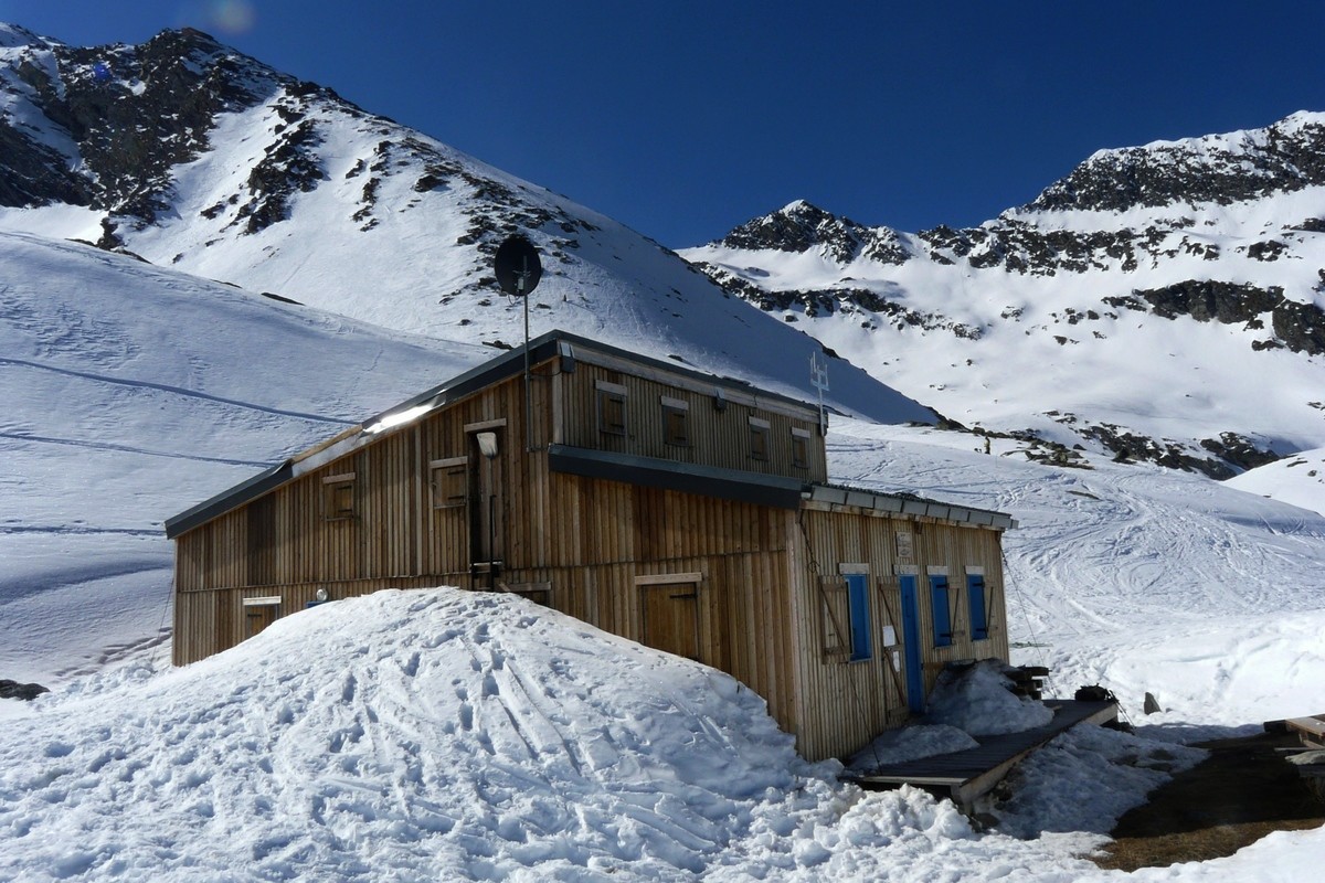
Refuge du Plan des Gouilles
2,352 m · Savoie · France
A wooden FFCAM hut on a terrace above the Champagny valley in the Vanoise, under the glaciated north side of the Grand Bec and at the foot of the Becca Motta. It sits just outside the Vanoise National Park. Walkers on the Tour de la Grande Casse and the Tour du Vallaisonnay stop here, and it is the starting point for the glacier routes to the Grand Bec and the Pointe du Vallonnet.
Staffed in season · 2026: Ascension and Pentecost weekends in May, then 30 May – 7 September · 40 beds · winter room
History and people
Run by FFCAM (Fédération française des clubs alpins et de montagne), Club Alpin Français Vanoise Tarentaise section.
- 1974 Hut built (Wikidata, citing FFCAM data, gives 1976). ↗
Good to know
Getting there and climbing from here
- From Le Bois, Champagny-le-Haut (1,469 m) · Waymarked path, mostly through conifer forest, then alpine meadows · about 2.5 h, +900 m
- From Pont des Chailles, Champagny-en-Vanoise (1,189 m) · Via the Chalets de Méribel · about 4 h, +1,150 m
- From Plan Fournier above Le Planay (1,723 m) · Past the Tour du Merle and the Chalets de Méribel · about 3 h, +820 m
Base for: Grand Bec (glacier route over the Troquairou glacier) · Pointe du Vallonnet (glacier route) · Becca Motta (rocky summit directly above the hut)
Staying: Through the FFCAM booking site. Outside the staffed season a 28-place part stays open (with bedding, stove, wood and gas); booking for it is asked on the FFCAM site. ↗
Peaks it serves
- Pointe du Vallonnet 3,372 m · last night before the summit
- Col des Volnets 3,218 m · last night before the summit
- La Becquetta 2,898 m · last night before the summit
- Grand Bec 3,398 m · 2.4 km away
- Becca Motta 3,042 m · 1.1 km away
Routes
- Pointe du Vallonnet: Le Grand Bec : Traversée Pointe du Vallonnet → Grand Bec (depuis le refuge du Plan des Gouilles) last night here · PD+
- Col des Volnets: Le Grand Bec : Traversée Pointe du Vallonnet → Grand Bec (depuis le refuge du Plan des Gouilles) last night here · PD+
- La Becquetta: Voie Normale last night here · F
Weather forecast
Loading forecast…
More forecasts: Météo-France mountain · yr.no · meteoblue · Windy · Mountain-Forecast.com
Avalanche danger: Météo-France avalanche risk — always read the current bulletin.
Map
Nearby: Champagny le Haut trailhead · 1,465 m · 1.6 km · Grand Bec Glacier glacier · 1.7 km · Refuge du Bois lodge · 1,470 m · 1.7 km · Culaz Glacier glacier · 2.1 km · Le Couaz trailhead · 1,450 m · 2.4 km · Chambéranger trailhead · 1,800 m · 2.8 km · Glacier de la Vuzelle glacier · 2.9 km · Refuge du Grand Bec hut · 2,405 m · 3.2 km
Links
Sources
Researched 2026-11-16 (high confidence) from: www.refugeduplandesgouilles.fr/ · www.refugeduplandesgouilles.fr/acc%C3%A8s/dep... · www.refugeduplandesgouilles.fr/au-refuge/en-%... · www.refugeduplandesgouilles.fr/activit%C3%A9s... · refugeplandesgouilles.ffcam.fr/ · refugeplandesgouilles.ffcam.fr/acces.html · www.refuges.info/point/291/refuge-garde/refug... · www.camptocamp.org/waypoints/104161 · fr.wikipedia.org/wiki/Becca_Motta · www.wikidata.org/wiki/Q120317831
Wikidata (CC0) · Camptocamp (CC BY-SA)