 My Dream Peaks
Hut
Refuge du Grenairon
1,974 m · Haute-Savoie · France
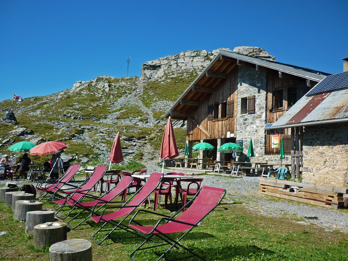
A staffed hut of stone and timber on the Grenairon pasture high above Sixt-Fer-à-Cheval in the Giffre valley, at the edge of the Sixt nature reserve, with a wide view of Mont Blanc and the Fiz chain. It is the classic overnight before the Mont Buet from the Sixt side, and a stage on several multi-day tours: Tour des Fiz, Tour du Haut-Giffre, Tour du Ruan and Tour du Pays du Mont-Blanc. Ibex are often seen around it, and a goat farm makes cheese at the pasture next door.
Staffed in season · mid-June – mid-September (2026: 13 June – 13 September) · 85 beds · winter room
History and people
Run by Private hut, run by its guardians.
- 1910 Built, as one of the first huts in the commune of Sixt-Fer-à-Cheval (also called the Chalet-hôtel du Buet). ↗
- 1984 The old building was destroyed by fire after a lightning strike. ↗
- 1985 Rebuilt as it had been before. ↗
- 2014 The Grenairon pasture was brought back into use by a goat farm (La Ferme de Passy). ↗
- 2022 Two geodesic dome tents with clear roofs added for two-person stays. ↗
Good to know
- Water comes from the source of the Nant Sec torrent: each season about 700 m of pipe is laid to fill a buffer tank; electricity is solar. ↗
- Mont Buet above the hut is nicknamed the 'Mont Blanc des Dames'; the Deluc brothers of Geneva reached its summit from Sixt in 1770. ↗
- The chevriers at the Grenairon pasture make goat's cheese on site and sell it there. ↗
Getting there and climbing from here
- From Hameau de Passy parking (about 1,000–1,110 m), Sixt · track to the Croix des Vagnys, then the Sentier des Gardes; delicate in a thunderstorm · about 2.5 h, +900 m
- From Pont de Nant Sec parking at La Feulatière (896 m) · Sentier des Gardes along the Nant Sec torrent, or the track past the Cascade du Rouget and the Chalets des Crépines (the two make a loop) · about 3.5 h, +1,050 m
Base for: Mont Buet (about 5 h and 1,150 m from the hut) · Le Cheval Blanc (2,831 m) (about 4 h 30, 860 m)
Staying: Online booking through the Tour du Pays du Mont-Blanc hut system linked from the hut website, or by phone; five dormitories with duvets, a sleeping-bag liner is required. Outside the staffed season the annex is open with mattresses and blankets. ↗
Peaks it serves
- Mont Buet 3,096 m · last night before the summit
- Pointe du Genevrier 2,870 m · last night before the summit
- Le Cheval Blanc 2,831 m · last night before the summit
- Grenier de Commune 2,775 m · last night before the summit
Routes
- Mont Buet: Le Buet : En boucle par les Frêtes du Grenier et les Beaux Prés last night here · T4
- Pointe du Genevrier: Pointe du Genévrier : De Salvagny (Sixt) last night here · T3
- Le Cheval Blanc: Par les Frêtes du Grenier last night here · T3
- Grenier de Commune: Le Grenier de Commune : A/R depuis Salvagny last night here · T4
Weather forecast
Loading forecast…
More forecasts: Météo-France mountain · yr.no · meteoblue · Windy · Mountain-Forecast.com
Avalanche danger: Météo-France avalanche risk — always read the current bulletin.
Map
Nearby: Refuge des Fonts hut · 1,368 m · 1.6 km · Les Fardelay trailhead · 1,040 m · 2.0 km · La Feulatière trailhead · 895 m · 2.1 km · Cascade du Rouget waterfall · 1,000 m · 2.1 km · Passy (Sixt) trailhead · 1,050 m · 2.3 km · Salvagny trailhead · 925 m · 2.4 km · Refuge Alfred Wills hut · 1,810 m · 3.1 km · Le Crot ou l'Écharny trailhead · 818 m · 3.2 km
Links
Sources
Researched 2026-11-15 (high confidence) from: grenairon.com/ · grenairon.com/le-refuge/ · grenairon.com/le-refuge-venir-nous-voir/ · grenairon.com/les-randonnees/ · fr.wikipedia.org/wiki/Refuge_du_Grenairon · www.monrefugepaysdumontblanc.com/fr/il4-refug... · www.camptocamp.org/waypoints/104051 · www.wikidata.org/wiki/Q16510603
Wikidata (CC0) · Camptocamp (CC BY-SA)