 My Dream Peaks
Hut
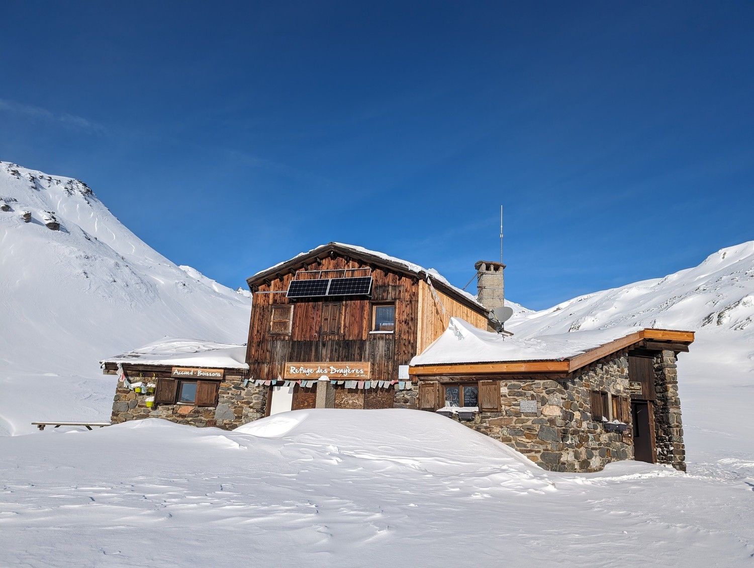
Refuge des Drayères
2,180 m · Hautes-Alpes · France
A French Alpine Club (FFCAM) hut at the head of the Clarée valley above Névache, in the Cerces–Thabor area of the Hautes-Alpes. It stands in a lake-dotted basin near Lac Rond, Lac du Grand Ban and the source of the Clarée, and is a stage on the GR57 Tour du Mont Thabor. In summer it is an easy family hut; in late winter it is a base for ski tours to Roche Château, the Rocher de la Grande Tempête and the Pointe des Cerces.
Staffed in season · winter: early February – mid-April (2026–27: 28 Dec – 2 Jan, then 29 Jan – 10 Apr); summer: early June – mid-September (2026: 17 June – 27 September) · 60 beds · winter room
History and people
Run by FFCAM (Fédération française des clubs alpins et de montagne); the hut site lists the FFCAM Isère departmental committee as manager.
Good to know
- Camping near the hut is regulated by a prefectoral order for the Clarée Natura 2000 area: bivouacs must be more than 500 m from the hut, pitched no earlier than 18:00 and gone by 09:00. ↗
- In summer the road up the valley is open to the Laval / Pont du Moutet car parks; in winter it is closed far lower down and the approach from Névache takes 3–4 hours. ↗
- Staffed service was suspended until 28 June 2024 because algae had polluted the water supply. ↗
Getting there and climbing from here
- From Pont du Moutet / Laval car parks at the end of the Clarée valley road (about 2,030 m) · 4x4 track closed to traffic · about 1 h
- From Névache (1,590 m), winter · up the snow-covered valley road · about 3.5 h
- From Bonnenuit (1,730 m) above Valloire, winter · over the Col des Rochilles; for experienced ski tourers · about 4.5 h, +770 m
Base for: Mont Thabor (on the GR57 Tour du Mont Thabor) · Pointe des Cerces (via the Seuil des Rochilles and Col des Cerces; ski tour or climb) · Rocher de la Grande Tempête (via Lac Rond des Muandes) · Roche Château (ski or snowshoe tour up the Lau valley)
Staying: Online booking on the FFCAM hut site, or by e-mail/phone. Dorms of 4, 6 and 8. Outside the staffed season a 24-place room (three 8-bunk dorms) is normally open, with no water, gas or heating and an outside dry toilet — but it is shut while building works are on (November 2026). ↗
Peaks it serves
- Mont Thabor 3,178 m · last night before the summit
- Col de la Ponsonnière 2,613 m · last night before the summit
- Pointe des Cerces 3,097 m · 2.3 km away
- Pic de la Moulinière 3,073 m · 3.2 km away
- Rocher de la Grande Tempête 3,002 m · 4.0 km away
- Roche du Chardonnet 2,950 m · 4.0 km away
- Rochers de la Grande Paré 2,950 m · 4.2 km away
Routes
- Mont Thabor: Depuis le refuge des Drayères last night here · T2
- Mont Thabor: Traversée des Cerces : Tour des Cerces depuis le Pont de l'Alpe par le refuge des Drayères last night here · T3
- Mont Thabor: Traversée des Cerces : boucle depuis Névache last night here · T4
- Col de la Ponsonnière: Pointe des Cerces : dalla valle della Clarèe last night here · T3
Weather forecast
Loading forecast…
More forecasts: Météo-France mountain · yr.no · meteoblue · Windy · Mountain-Forecast.com
Avalanche danger: Météo-France avalanche risk — always read the current bulletin.
Map
Nearby: Lac Rond lake · 2,448 m · 2.1 km · Grand Ban Lake lake · 2,465 m · 2.7 km · Névache - Laval trailhead · 2,024 m · 2.7 km · Refuge de Laval hut · 2,030 m · 3.1 km · Chambres d'hôtes Les Assalis, au coeur des alpages de la Clarée lodge · 2,000 m · 3.4 km · Lac de la Ponsonnière lake · 2,340 m · 4.2 km · Refuge de Ricou hut · 2,115 m · 4.8 km · Refuge de Terre Rouge hut · 2,182 m · 5.5 km
Links
Sources
Researched 2026-11-15 (high confidence) from: refugedesdrayeres.ffcam.fr/ · refugedesdrayeres.ffcam.fr/acces.html · refugedesdrayeres.ffcam.fr/gestionnaire.html · refugedesdrayeres.ffcam.fr/activites.html · refugedesdrayeres.ffcam.fr/bivouac.html · refugesclareethabor.com/refuges/refuge-des-drayeres · www.refuges.info/point/409 · it.wikipedia.org/wiki/Refuge_des_Dray%C3%A8res · de.wikipedia.org/wiki/Refuge_des_Dray%C3%A8res · www.wikidata.org/wiki/Q16595088 · api.camptocamp.org/waypoints/104114
Wikidata (CC0) · Camptocamp (CC BY-SA)