 My Dream Peaks
Hut
Habert d'Aiguebelle
1,740 m · Isère · France
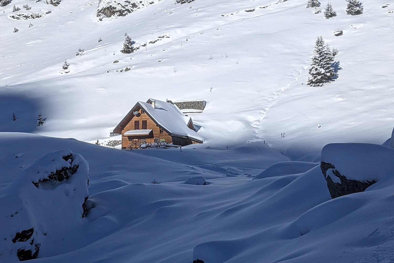
A small staffed refuge in the Belledonne range above the Grésivaudan valley, in the commune of Laval-en-Belledonne (Isère), at the foot of the Vénétier combe. It was rebuilt on the walls of an old shepherds' hut ('habert') and sits on the GR 738 Haute Traversée de Belledonne. Walkers use it as a stage on the GR 738 or for the Vénétier lakes and the Cime de la Jasse, and ski tourers come here in winter from Prabert and Prapoutel.
Staffed in season · about 15 January – 15 October; no winter room (in winter, overnight only by arrangement) · 38 beds
History and people
Run by Association LM7 (private; also runs the Refuge des Sept Laux).
Good to know
- The refuge stands on the GR 738, the high traverse of the Belledonne range. ↗
- There is no mobile signal or Wi-Fi at the hut; Camptocamp users say a short walk to a small rise to the left of the hut, where the Grésivaudan comes into view, can give a signal. ↗
- A trail race to the hut (10 km, about 1,000 m of climb) is held each June. ↗
Getting there and climbing from here
- From Pont de la Betta car park, Prabert road (about 1,300 m) · up the Muret valley · about 1.5 h
- From Parking du Muret (1,350 m), Route du Pré de l'Arc above Prabert · up the Muret valley · about 1 h
- From Prapoutel ski station · over the ridge to the Cime de la Jasse and down its normal route (or by lift to Col du Pouta in winter) · about 2.5 h
Base for: Cime de la Jasse (about 2 h from the hut) · Dôme du Vouteret (south side via Col de l'Aigleton, a ski-touring classic) · Pointe du Sifflet (north ridge)
Staying: By phone or email to the guardians (details on the hut website); a deposit by cheque confirms the booking. Cards are not accepted. Half board, duvets and sheets provided. ↗
Peaks it serves
- Pas de la Coche 1,989 m · last night before the summit
Routes
- Pas de la Coche: Col de l'Aigleton : traversée SE-SW depuis Prabert last night here · T3
- Pas de la Coche: Dôme de la Coche : Pas de la Coche - Versant NW last night here · T2
- Pas de la Coche: Col de la Vache : Tour de la Belle Etoile par les 7 laux last night here · T3
- Pas de la Coche: Pointe Centrale S du Ferrouillet : Tour Brèche de Roche Fendue >> Pas de la Coche - depuis Prabert last night here · T3
- Pas de la Coche: Pointe du Sciallet : Versant E - depuis Prabert last night here · T3
- Pas de la Coche: Dent du Pra : Tour du vénétier par les arêtes last night here · PD+
Weather forecast
Loading forecast…
More forecasts: Météo-France mountain · yr.no · meteoblue · Windy · Mountain-Forecast.com
Avalanche danger: Météo-France avalanche risk — always read the current bulletin.
Map
Nearby: Route du Pré de l'Arc (Prabert) - Parking du Muret trailhead · 1,350 m · 1.8 km · Route du Pré de l'Arc (Prabert) - Parking du Pont de la Betta trailhead · 1,300 m · 2.1 km · Route du Pré de l'Arc (Prabert) - Parking de l'Olagneraie trailhead · 1,220 m · 2.7 km · Le Rivier d'Allemont trailhead · 1,265 m · 2.7 km · Cascade des 7 Laux trailhead · 1,280 m · 3.5 km · Cascade des Sept Laux waterfall · 1,280 m · 3.8 km · Prapoutel trailhead · 1,325 m · 4.3 km · Pipay trailhead · 1,550 m · 4.6 km
Links
Sources
Researched 2026-11-15 (medium confidence) from: refugedaiguebelle.fr/ · www.alpes-isere.com/sit/refuge-le-habert-daig... · www.refuges.info/point/5576/gite-d-etape/habe... · www.camptocamp.org/waypoints/103995 · www.camptocamp.org/images/1720729 · api.camptocamp.org/routes/1582871 · api.camptocamp.org/routes/486190
Camptocamp (CC BY-SA)