 My Dream Peaks
Hut
Refuge de l'Oule (Antoine Cros)
1,836 m · Isère · France
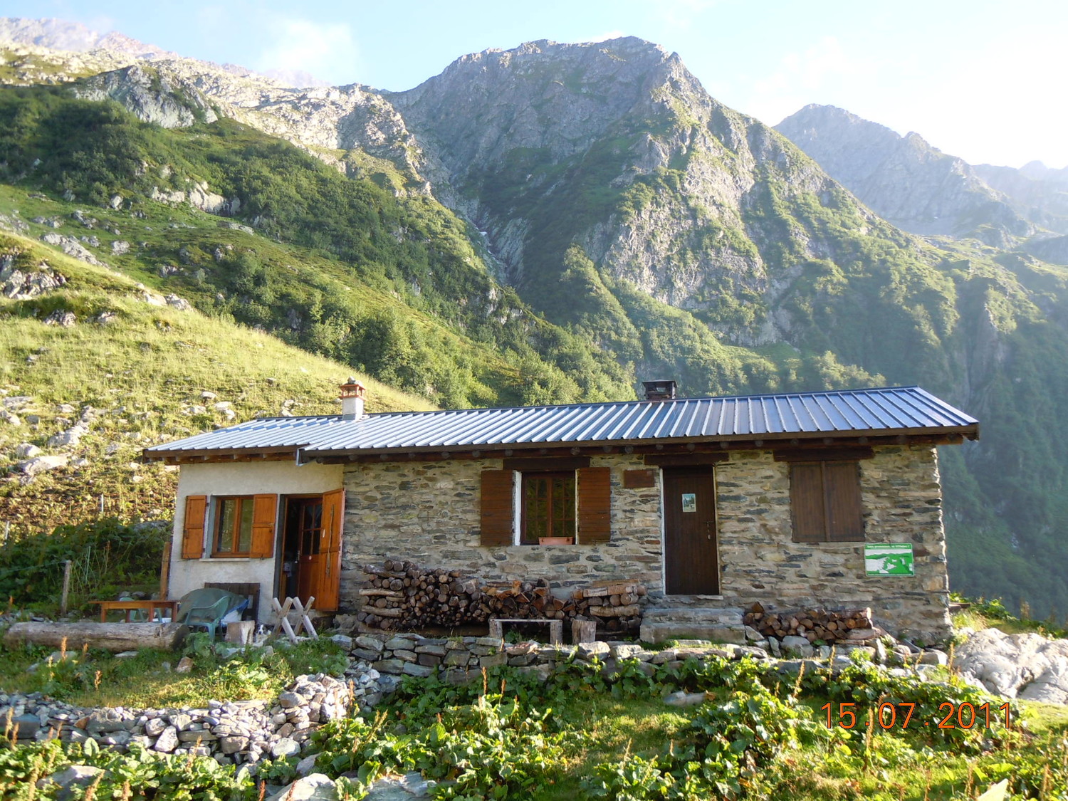
A small stone refuge in the northern Belledonne range, above the hamlet of Gleyzin in the commune of Haut-Bréda (Pinsot, Isère), under the Puy Gris and the Col du Morétan. It started life as a summer alpine-pasture house, and a shepherd still grazes a flock on the slopes around it. In summer it has a guardian; the rest of the year it stays open as an unstaffed shelter used mostly by ski tourers and winter climbers heading for the couloirs and ridges above.
Staffed in season · guarded 20 June – 13 September (2026); open as an unstaffed shelter the rest of the year · 20 beds · winter room
History and people
Named after Antoine Cros, Allevard man behind the growth of skiing in the commune, founder of the Allevard ski club in 1923.
Run by Commune of Haut-Bréda (Pinsot town hall is the contact, per refuges.info), with a summer guardian.
- 1924 The former alpine-pasture house was given to the Club Alpin Français by the Ski Club Allevardin and Antoine Cros (reported in the CAF magazine La Montagne, January 1925). ↗
- 2018 An annex (for the guardian) and a terrace in front of the winter entrance were built. ↗
- Antoine Cros named after: Founded the Allevard ski club in 1923 and, with the Ski Club Allevardin, gave the hut to the CAF in 1924. ↗
Good to know
Getting there and climbing from here
- From Gleyzin, La Bourgeat Noire car park (about 1,100 m) · the Puy Gris path up the Oule meadow, over the concrete bridge to the Oule ledge (1,720 m) and a short final climb · about 2.5 h, +900 m
Base for: Le Grand Morétan (from Gleyzin via the hut and Col N du Gleyzin) · Puy Gris (overlooks the hut) · Pic N des Grandes Lanches (west couloirs, ski touring and winter climbing) · Charmet de l'Aiguille (north ridge)
Staying: By phone to the guardian in summer (numbers on the tourist-office listing); outside the season, payment goes in the hut's box or to the town hall. Bring a sleeping bag. ↗
Peaks it serves
- Puy Gris 2,908 m · last night before the summit
- Pointe de Comberousse 2,866 m · last night before the summit
- Le Charmet de l'Aiguille 2,826 m · last night before the summit
- Le Grand Morétan 2,775 m · last night before the summit
Routes
- Puy Gris: Arête W last night here · F
- Puy Gris: arête W et traversée depuis le col de la Valloire last night here · F+
- Puy Gris: Écharpe N last night here · D
- Pointe de Comberousse: Face NW de l'antécime last night here · AD-
- Le Charmet de l'Aiguille: Arête N last night here · PD
- Le Grand Morétan: Depuis Gleyzin last night here · T4
Weather forecast
Loading forecast…
More forecasts: Météo-France mountain · yr.no · meteoblue · Windy · Mountain-Forecast.com
Avalanche danger: Météo-France avalanche risk — always read the current bulletin.
Map
Nearby: Chalet Hippolyte Chassande Barroz du Lac Léat hut · 1,720 m · 2.1 km · Refuge de Tigneux hut · 1,685 m · 2.5 km · Gleyzin (La Bourgeat Noire) trailhead · 1,100 m · 2.7 km · Deuxième Chalet de la Petite Valloire (ou de la Fouetterie) hut · 1,779 m · 2.8 km · Chalet du Bout hut · 1,398 m · 2.9 km · Abri de la Grande Valloire shelter · 1,830 m · 3.2 km · Abri de l'Aup Bernard hut · 1,585 m · 3.3 km · Refuge du Merlet hut · 1,940 m · 3.5 km
Links
Sources
Researched 2026-11-15 (medium confidence) from: www.camptocamp.org/waypoints/104079 · www.refuges.info/point/58/refuge-garde/L-Oule... · www.allevard-les-bains.com/en/offres/refuge-d... · www.camptocamp.org/images/359053 · api.camptocamp.org/routes/791712 · api.camptocamp.org/routes/474132 · api.camptocamp.org/routes/570948 · www.wikidata.org/wiki/Q120231747
Camptocamp (CC BY-SA)