 My Dream Peaks
Hut
Refuge des Fonts
1,368 m · Haute-Savoie · France
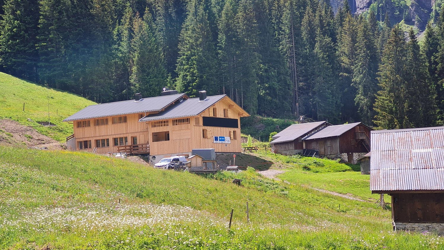
A family-run hut in the Cirque des Fonts above Sixt-Fer-à-Cheval in the Giffre valley, set above a cluster of about forty summer pasture chalets and ringed by cliffs under Mont Buet. It is an easy walk in (1.5–2 h) through forest and past waterfalls, a stage on the Tour des Fiz, and a start for the quiet side of Mont Buet. A new building, built next to the old century-old alpine chalet, opened in 2026, the hut's hundredth year.
Staffed in season · late May – mid-October (2026: 23 May – 11 October) · 35 beds
History and people
Run by Private, family-run (Nathalie and Benoit Bouvet, fourth generation of guardians).
- 1926 Hut opened in the Cirque des Fonts, in an old alpine chalet. ↗
- 2024 Work began on a new building beside the old hut, co-funded by the EU (40 %), the Auvergne-Rhône-Alpes region (28 %) and the French state (12 %); the old hut stayed open meanwhile. ↗
- 2026 New building opened in June after two years of work. ↗
Good to know
- Nathalie and Benoit are the fourth generation of the same family to keep the hut. ↗
- The walk in from Salvagny passes the Cascade du Rouget and gives views of the three-step Cascade d'Anterne before following the Fonts gorge. ↗
- Power comes from solar panels, so phone charging at the hut is very limited. ↗
Getting there and climbing from here
- From Les Fardelays hamlet, above Salvagny (about 1,040 m) · across the field to the Creux du Oua bridge over the Giffre des Fonts gorge, then up through forest past the Chalet de la Célière and along the Fonts gorge · about 1.5 h
- From La Fontaine car park, above Salvagny · forest track towards the Fonts, past the Grenairon turn-off, then the same route along the gorge · about 2 h
Base for: Mont Buet (via the Col des Chaux, about 4 h 30 (the 'hidden face'); loop back via the Grenairon about 7 h)
Staying: Pre-booking form on the hut website, confirmed by the guardians; for arrivals within 48 h, phone the hut. Small heated dorms of 3–7 places and one double room; duvets and sheet liners provided. ↗
Peaks it serves
- Mont Buet 3,096 m · last night before the summit
- Tête de Villy 2,481 m · last night before the summit
- Grenier de Commune 2,775 m · 3.2 km away
- Col d'Anterne 2,257 m · 4.7 km away
Routes
- Mont Buet: Le Buet : Grand couloir W last night here · D-
- Mont Buet: Le Buet : Par la Guivre (ou la Guvre) last night here · T5
- Tête de Villy: Frêtes de Villy : en boucle depuis Sixt par le Pas au Mulet last night here · T4
- Tête de Villy: Frêtes de Villy : De Sixt par les Fonts et le Bas du Col d'Anterne last night here · T2
Weather forecast
Loading forecast…
More forecasts: Météo-France mountain · yr.no · meteoblue · Windy · Mountain-Forecast.com
Map
Nearby: Refuge du Grenairon hut · 1,974 m · 1.6 km · Abri du col des Chaux shelter · 2,330 m · 2.3 km · Refuge Alfred Wills hut · 1,810 m · 2.4 km · Les Fardelay trailhead · 1,040 m · 2.7 km · Château ou Abri de Pictet bivouac · 3,040 m · 3.0 km · Cascade du Rouget waterfall · 1,000 m · 3.1 km · Lac d'Anterne lake · 2,063 m · 3.4 km · Passy (Sixt) trailhead · 1,050 m · 3.9 km
Links
- Hut website official website
- Facebook page (linked from the hut website)
- refuges.info
- Camptocamp
Sources
Researched 2026-11-15 (high confidence) from: www.lesfonts.com/ · www.camptocamp.org/waypoints/104117 · www.camptocamp.org/images/1914300 · www.refuges.info/point/356 · www.wikidata.org/wiki/Q120318466 · www.facebook.com/RefugeDesFontsSixt/
Camptocamp (CC BY-SA)