 My Dream Peaks
Hut
Baraque des Clos
1,557 m · Isère · France
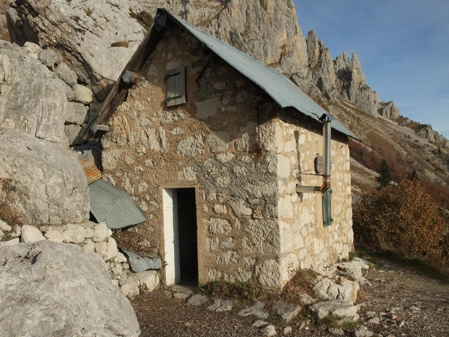
A small free stone shelter on the eastern balcony of the Vercors, below the cliffs of the Deux Sœurs and the Moucherolles, in the Vercors regional natural park (Isère). It sits where the 'sentier du périmètre' balcony path meets the trail up from Prélenfrey, and is open to anyone on a first-come basis. Walkers and climbers use it for a night before the Deux Sœurs crest, the Grande Moucherolle or the limestone routes above.
Not staffed · open all year, free · 10 beds
History and people
Run by Office National des Forêts (ONF).
- 2016 The stove pipe was rebuilt, curing the stove's poor draught. ↗
Good to know
- Water is unreliable: the Clos spring, about 20 minutes above the hut, can be dry from June until the autumn rains. ↗
- The approach crosses avalanche paths in winter; in March 2026 an avalanche blocked the main door and visitors had to use the upstairs door. ↗
- The hut has a stove but no saw that works (2025) — visitors are asked to bring a small saw, newspaper and a broom to leave there. ↗
Getting there and climbing from here
- From End of the Bordeaux forest road above Prélenfrey · forest track and path · about 0.75 h
- From Col de l'Arzelier (1,154 m) · the Balcons Est path, then a traverse across the slope, +600 m
Base for: Les Deux Sœurs (Pointe Sophie, Pointe Agathe, Dôme de l'Œille) (crest traverse via the Col des Deux Sœurs) · La Grande Moucherolle (linked with the Deux Sœurs and the Petite Moucherolle)
Staying: No booking; first come, first served. Sleeping is on the upstairs floor: bring a mat and sleeping bag (mattresses gone as of December 2025). ↗
Peaks it serves
- Grande Sœur Agathe 2,193 m · last night before the summit
- Petite Sœur Sophie 2,162 m · last night before the summit
- La Grande Moucherolle 2,284 m · 1.8 km away
- Arêtes du Gerbier 2,109 m · 1.9 km away
- Rochers de la Balme 2,063 m · 4.3 km away
Routes
- Grande Sœur Agathe: Prélenfrey : Pointe Sophie - Pointe Agathe - Grande Moucherolle - Petite Moucherolle last night here · T5
- Grande Sœur Agathe: Les Deux Sœurs - Pointe Sophie : Traversée des Crêtes Dôme de l'Oeille → Col des 2 Soeurs last night here · T5
- Grande Sœur Agathe: Col des Deux Soeurs - Petite Soeur Sophie - Pas de L'Oeille - depuis le col de L'Arzelier last night here · T4
- Petite Sœur Sophie: Prélenfrey : Pointe Sophie - Pointe Agathe - Grande Moucherolle - Petite Moucherolle last night here · T5
- Petite Sœur Sophie: Les Deux Sœurs - Pointe Sophie : Traversée des Crêtes Dôme de l'Oeille → Col des 2 Soeurs last night here · T5
- Petite Sœur Sophie: Col des Deux Soeurs - Petite Soeur Sophie - Pas de L'Oeille - depuis le col de L'Arzelier last night here · T4
Weather forecast
Loading forecast…
More forecasts: Météo-France mountain · yr.no · meteoblue · Windy · Mountain-Forecast.com
Avalanche danger: Météo-France avalanche risk — always read the current bulletin.
Map
Nearby: La Soldanelle hut · 1,500 m · 1.6 km · Col de l'Arzelier trailhead · 1,154 m · 2.1 km · Le Mauret trailhead · 1,201 m · 2.3 km · Prélenfrey trailhead · 960 m · 2.4 km · Refuge du Grand Couloir hut · 2,050 m · 2.7 km · Bivouac du Gerbier bivouac · 1,580 m · 2.8 km · Cabane forestière de Font Bessou shelter · 1,310 m · 3.0 km · Abri de la Fauge hut · 1,300 m · 4.3 km
Links
Sources
Researched 2026-11-15 (medium confidence) from: www.camptocamp.org/waypoints/109273 · www.refuges.info/point/32/cabane-non-gardee/B... · www.alpes-isere.com/en/sit/baraque-des-clos-5708120/ · api.camptocamp.org/routes/656585 · api.camptocamp.org/routes/465738 · api.camptocamp.org/routes/1355208 · www.camptocamp.org/routes/465738
Camptocamp (CC BY-SA)