 My Dream Peaks
Shelter
Bivacco Alfredo Redaelli
3,300 m · Grisons · Switzerland
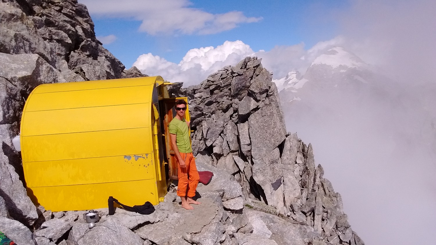
A small yellow emergency bivouac box bolted to the rocks a few metres from the summit of Piz Badile (Pizzo Badile, 3,308 m), on the Italian–Swiss border between Val Masino and Val Bregaglia. It is unstaffed and always open, and is meant for parties caught out on top after the North Ridge (Nordkante) or the Cassin route on the north-east face, or before the long descent by the south ridge or by abseiling the North Ridge. There is no water and no stove: bring both, or count on melting snow only early in the season.
Not staffed · open all year (emergency shelter)
History and people
Run by CAI Lecco – Gruppo Ragni (listed as the reference body).
- 1967 A CAI bivouac box was placed close to the summit of Piz Badile. ↗
Good to know
- The Italian Wikipedia also says a bivouac has stood near the summit since 1967. ↗
- Inside there are a few pots and some cutlery, seven mattresses and blankets, but no stove, no lighter and no water; snow may still lie near it until late July. ↗
- The easiest way down from the summit is the south ridge to Rifugio Gianetti in Italy; parties who must get back to Switzerland usually cross Passo di Bondo or Passo della Trubinasca, or abseil the North Ridge, a long descent where some parties are benighted. ↗
Getting there and climbing from here
- From Rifugio Gianetti (Val Porcellizzo, Italy) · Normal route up the south face/south ridge (grade II+, places of III)
- From Capanna Sasc Furä (Val Bondasca, Switzerland) · North Ridge (Nordkante), rock climbing to IV+
Base for: Pizzo Badile (the bivouac is right by the summit)
Staying: No booking: an emergency shelter on the summit; bring water, stove and food. ↗
Peaks it serves
- Pizzo Badile 3,308 m · last night before the summit
Routes
- Pizzo Badile: Piz Badile : Voie Cassin last night here · TD
- Pizzo Badile: Piz Badile : Spigolo Marimonti et Arête E du Badile last night here · D
- Pizzo Badile: Piz Badile : Arête N (Spigolo N) last night here · D
- Pizzo Badile: Piz Badile : Face S, voie normale last night here · PD
Weather forecast
Loading forecast…
More forecasts: MeteoSwiss · yr.no · meteoblue · Windy · Mountain-Forecast.com
Avalanche danger: SLF avalanche bulletin — always read the current bulletin.
Map
Nearby: Rifugio Gianetti hut · 2,534 m · 1.6 km · Bivacco Pedroni-Dal Prà hut · 2,577 m · 1.7 km · Cap. Sasc Furä hut · 1,904 m · 2.3 km · Sciorahütte hut · 2,118 m · 2.7 km · Laret (Bondo) trailhead · 1,286 m · 3.2 km · Bivacco Molteni-Valsecchi hut · 2,510 m · 3.6 km · Refuge Omio hut · 2,100 m · 5.0 km · Rifugio Antonio Omio hut · 2,100 m · 5.2 km
Links
Sources
Researched 2026-11-16 (medium confidence) from: www.camptocamp.org/waypoints/121414 · api.camptocamp.org/waypoints/121414 · de.wikipedia.org/wiki/Piz_Badile · it.wikipedia.org/wiki/Pizzo_Badile · www.summitpost.org/piz-badile/151179 · www.camptocamp.org/images/790797
Camptocamp (CC BY-SA)