 My Dream Peaks
Hut
Refuge Hus (SCM)
1,160 m · Haut-Rhin · France
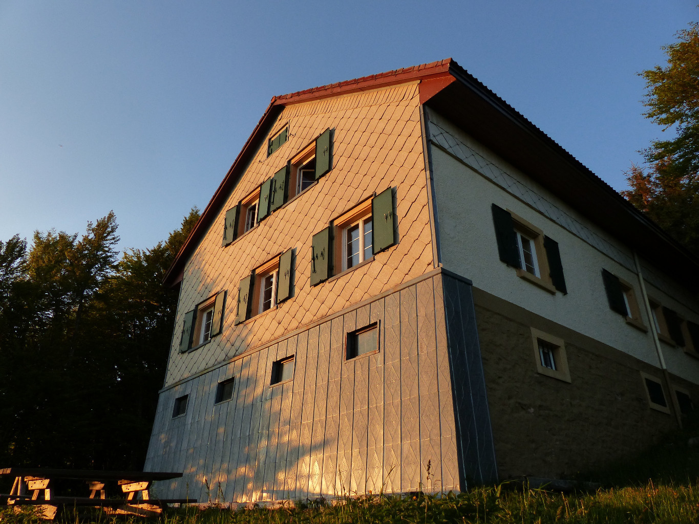
A club refuge of the Ski Club de Mulhouse at 1,160 m on the main ridge of the High Vosges, at the forest edge above the upper Thur valley in the commune of Kruth (Haut-Rhin), within the Ballons des Vosges regional park. It stands near the GR 5 and the Huss farm-inn, between the Markstein and the Schlucht on the Route des Crêtes. Hikers and ski tourers use it for a night on the crest walks; it is self-catering, with a shared kitchen.
· Open to passing hikers on reservation; at weekends a club member receives guests from Saturday afternoon to Sunday early afternoon · 31 beds
History and people
Run by Ski Club de Mulhouse (SCM).
- 1909 The Ski Club de Mulhouse was founded on 20 January; Alfred Spieser was among the founders. ↗
- 1912 The first HUS refuge was built, attached to the farm. ↗
- 1914 During the First World War the staff of the French 2nd mountain artillery regiment used the refuge as headquarters. ↗
- 1933 Fire destroyed the farm and the refuge. ↗
- 1934 A new refuge was built on the present site, largely by club members working with professionals. ↗
- 1945 Burned by an incendiary shell during the fighting on the crest. ↗
- 1949 The present refuge was inaugurated. ↗
Good to know
- The refuge is heated by a traditional Alsatian tiled stove (Kachelofen). ↗
- It can be reached without a car: the TER trains stop at Kruth and Metzeral, both a few hours' walk below. ↗
- In winter, when the Route des Crêtes is closed (roughly November to late April), the refuge can only be reached on foot or on skis; in fog the Herrenberg pass can be hard to find because of cornices. ↗
Getting there and climbing from here
- From Kruth railway station (about 480 m) · red rectangle with white bar, then blue disc markings · about 2 h, +680 m
- From Metzeral railway station (about 480 m) · GR 5 (red rectangle) over the Col du Herrenberg · about 3 h, +710 m
- From Route des Crêtes (about 9 km from the Markstein) · by road when the Route des Crêtes is open
Base for: Rothenbachkopf (on the main crest nearby) · Batteriekopf (crest walk) · Rainkopf (crest walk)
Staying: Book in advance through the reservation page of the club website (reservation by email is also suggested). No meals or drinks are sold; bring your own food and a sleeping bag or sheets. Groups up to 10–12; the whole refuge is not rented out. ↗
Peaks it serves
- Rothenbachkopf 1,315 m · last night before the summit
- Batteriekopf 1,311 m · last night before the summit
- Rainkopf 1,305 m · last night before the summit
Routes
- Rothenbachkopf: Refuge Hus (SCM) : De la vallée de Munster à la vallée de Saint Amarin (étape 2/2) last night here · T2
- Rothenbachkopf: Refuge Hus (SCM) : De la vallée de Munster à la vallée de Saint Amarin (étape 1/2) last night here · T2
- Batteriekopf: Refuge Hus (SCM) : De la vallée de Munster à la vallée de Saint Amarin (étape 2/2) last night here · T2
- Batteriekopf: Refuge Hus (SCM) : De la vallée de Munster à la vallée de Saint Amarin (étape 1/2) last night here · T2
- Rainkopf: Refuge Hus (SCM) : De la vallée de Munster à la vallée de Saint Amarin (étape 2/2) last night here · T2
- Rainkopf: Refuge Hus (SCM) : De la vallée de Munster à la vallée de Saint Amarin (étape 1/2) last night here · T2
Weather forecast
Loading forecast…
More forecasts: Météo-France mountain · yr.no · meteoblue · Windy · Mountain-Forecast.com
Map
Nearby: Cascade du Heidenbad waterfall · 1.7 km · Cascade du Bockloch waterfall · 2.5 km · Refuge de montagne du Ski-Club des Hautes Vosges hut · 3.6 km · Cabane du Lac de Blanchemer shelter · 995 m · 4.7 km · Lac de Blanchemer lake · 984 m · 4.7 km · Kruth trailhead · 468 m · 5.9 km · Fischboedle lake · 794 m · 6.0 km · Cascade Saint-Nicolas waterfall · 540 m · 6.6 km
Links
Sources
Researched 2026-11-15 (medium confidence) from: www.altitude1160.com/ · www.altitude1160.com/un-peu-dhistoire/ · www.altitude1160.com/le-refuge-2/ · www.altitude1160.com/acces-au-refuge/ · www.vosges-mountains.com/sit/233001003-mounta... · www.camptocamp.org/waypoints/593933 · www.refuges.info/point/3006
Camptocamp (CC BY-SA)