 My Dream Peaks
Hut
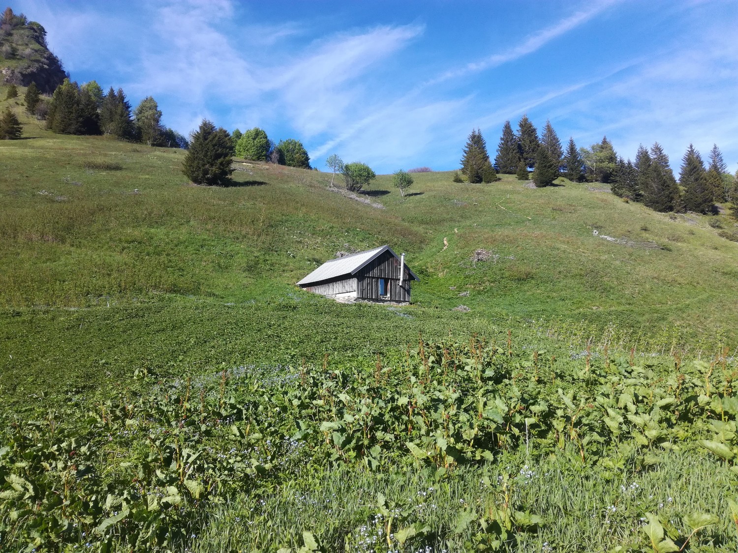
Chalet de l'Alpettaz
1,580 m · Savoie · France
A small unstaffed stone-and-timber chalet on an open alpine meadow at about 1,580 m in the eastern Bauges, on the slopes above Albertville just north-east of La Belle Étoile. It belongs to the commune of Mercury and is left open as a free shelter, with sleeping platforms for about 12 and a wood stove. People use it as a lunch or overnight stop on walks up La Belle Étoile and along the ridge from Les Combes or the Col de Tamié side.
Not staffed · open all year (free shelter) · 12 beds
Good to know
- The spring about 30 m below the chalet is unreliable: visitors found it dry in September 2020 and weak in November 2022, but flowing well in April and December in other years. ↗
- The ridge between the chalet and La Belle Étoile is exposed and needs sure footing; one visitor reports it as airy rather than frightening. ↗
- Not to be confused with the Chalet communal de l'Alpettaz, a different free hut at about 1,380 m some 4–5 km to the north-east, reached from the Raffort car park. ↗
Getting there and climbing from here
- From Hamlet of Les Combes (Seythenex) · Footpath up through the forest to the meadow, continuing on the crest towards La Belle Étoile (one visitor found the path different from the IGN map)
- From La Ramaz / Col de Tamié · Path across the slopes south-west of the Belle Étoile ridge
- From Allondaz · Path up from the village on the Albertville side
Base for: La Belle Étoile (1,841 m) (along the exposed crest above the chalet)
Staying: No booking; first come, first served. Bring a sleeping bag, mat and food; no blankets are provided, the stove flue has been patched, and visitors recommend carrying out litter. ↗
Peaks it serves
- Dent de Cons 2,062 m · last night before the summit
- Pointe de Cruessajran 1,961 m · last night before the summit
- Rocher Blanc 1,884 m · last night before the summit
- La Belle Étoile 1,841 m · last night before the summit
- Roc Rouge 1,720 m · last night before the summit
- Pointe de la Deuva 1,707 m · last night before the summit
Routes
- Dent de Cons: Traversée Dents de Cons → Belle Etoile par les crêtes last night here · T4
- Pointe de Cruessajran: Traversée Dents de Cons → Belle Etoile par les crêtes last night here · T4
- Rocher Blanc: Traversée Dents de Cons → Belle Etoile par les crêtes last night here · T4
- La Belle Étoile: Traversée Dents de Cons → Belle Etoile par les crêtes last night here · T4
- Roc Rouge: Traversée Dents de Cons → Belle Etoile par les crêtes last night here · T4
- Pointe de la Deuva: Traversée Dents de Cons → Belle Etoile par les crêtes last night here · T4
Weather forecast
Loading forecast…
More forecasts: Météo-France mountain · yr.no · meteoblue · Windy · Mountain-Forecast.com
Avalanche danger: Météo-France avalanche risk — always read the current bulletin.
Map
Nearby: Cruet Leu trailhead · 860 m · 1.6 km · Le sanglier trailhead · 750 m · 2.9 km · Cabane des Gardes shelter · 1,360 m · 2.9 km · Collet de Tamié - les Teppes trailhead · 1,080 m · 3.0 km · Parking des Teppes trailhead · 1,080 m · 3.0 km · Les Chaffauds (Bauges) trailhead · 930 m · 3.1 km · Le Planet trailhead · 960 m · 3.6 km · Route forestière du Piésan trailhead · 670 m · 4.3 km
Links
Sources
Researched 2026-11-15 (low confidence) from: www.camptocamp.org/waypoints/1119741 · www.refuges.info/point/1707 · www.refuges.info/point/4034 · api.camptocamp.org/images/1119745
Camptocamp (CC BY-SA)