 My Dream Peaks
Day 1 · Wednesday 4 November 2026
Find a peak, see how hard it is, rank them your way
A search that filters peaks by height, difficulty and month, three ratings on every route, and a rank page with your own weights.
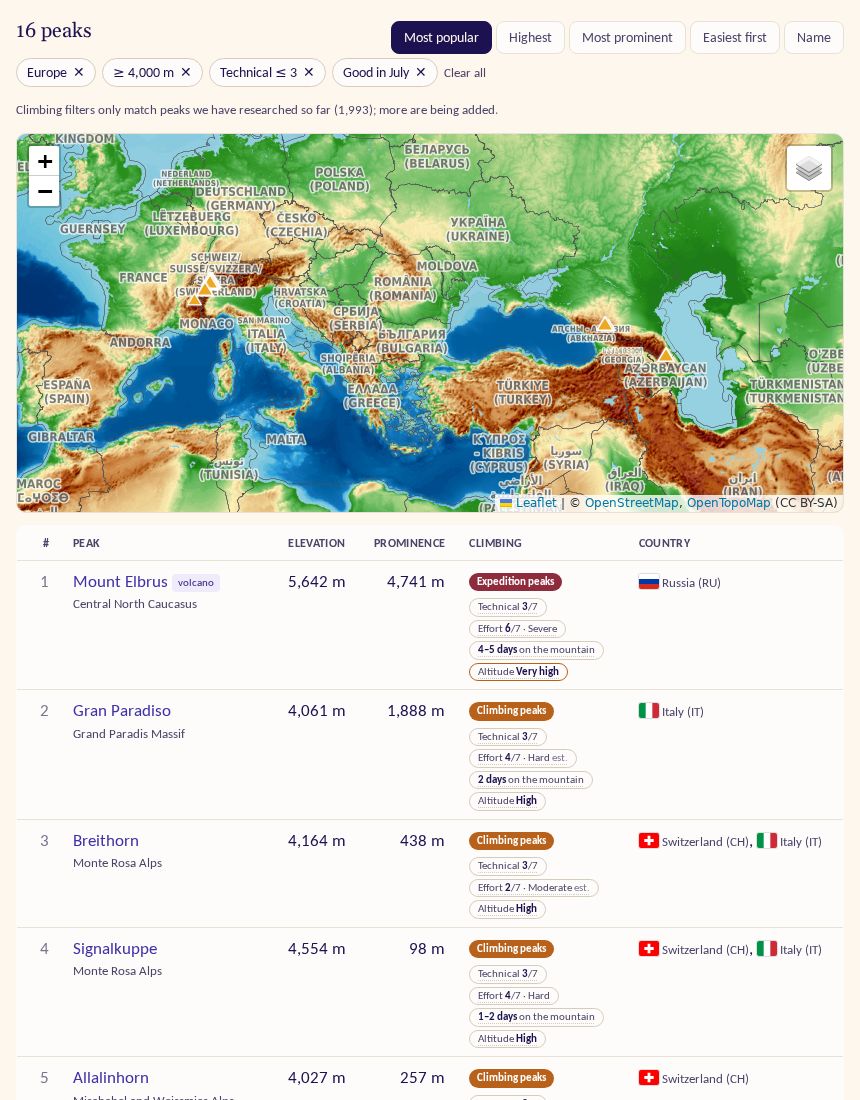
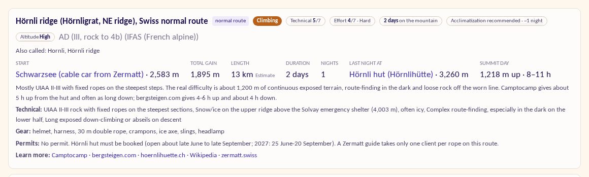
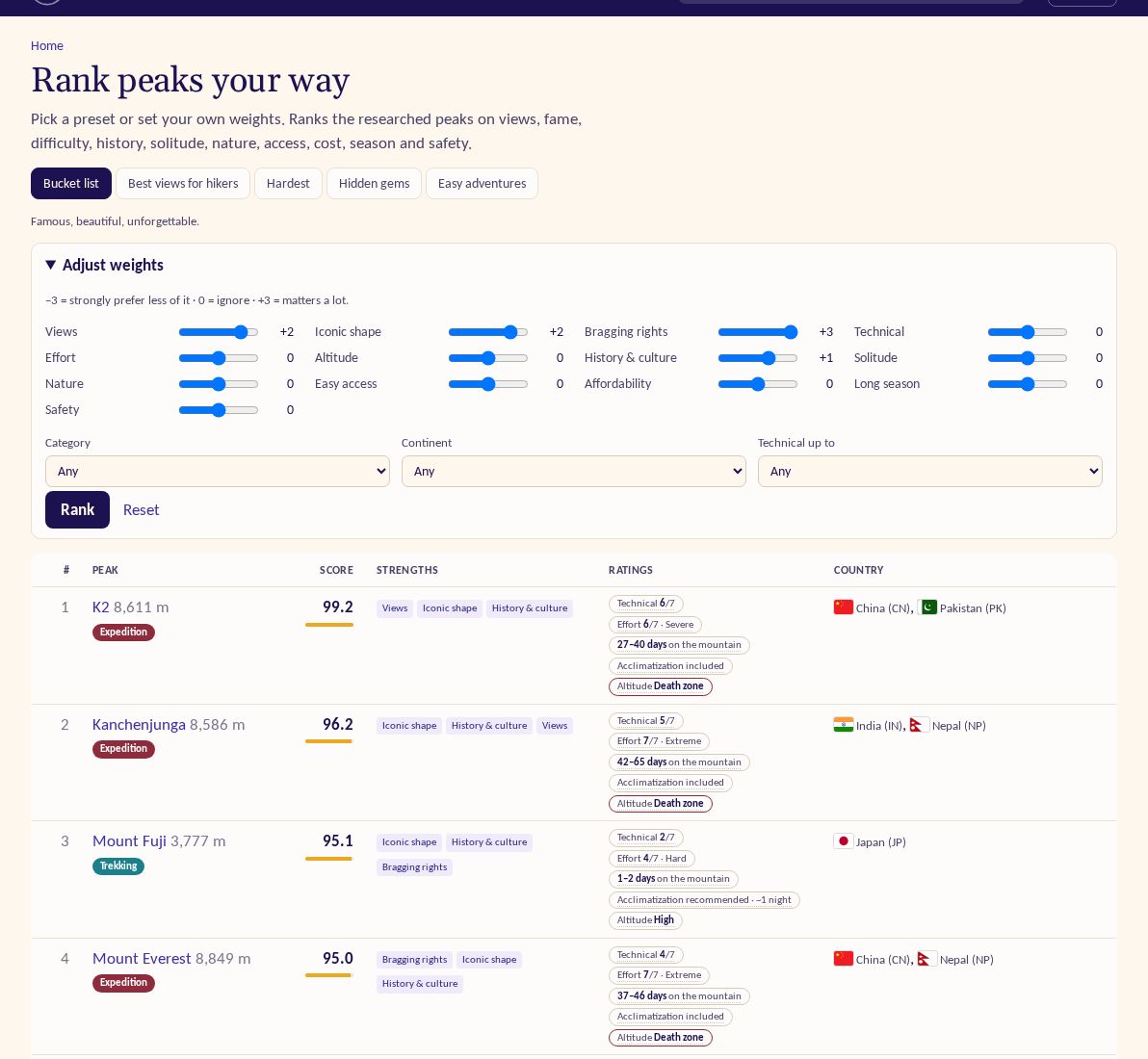
My Dream Peaks started on 4 November 2026 with a placeholder page and an empty database. By midnight a climber could look up almost any mountain in the world, filter peaks by what they actually want to do, see how hard each route is, and rank peaks by their own taste. Peter Zaitsev built it together with Claude, one small commit at a time: 81 of them on day one.
A search that answers "what could I climb in July?"
The first website went up in the afternoon: pages for continents, countries, regions, ranges and peaks, each with a map. Search suggests as you type, ranking peaks, ranges and countries on one scale, with arrow-key support.
By early evening the full search page arrived. It filters by name in any language, continent, country, region or range, height, prominence, type, list, category, technical difficulty, effort, altitude, trip length and the month you want to go. Each active filter shows as a chip you can remove with one click, and results come on a map and in a table you can sort by popularity, height, prominence or "easiest first". The screenshot shows European peaks over 4,000 m, technical 3 or less, good in July.
Three ratings on every route
A single "difficulty" number hides too much, so each route gets three:
- Technical, from 1 to 7: how hard the climbing itself is.
- Effort, from 1 to 7: the hardest single day, in altitude-weighted hours, with the days on the mountain shown next to it. It took three versions in one evening before Expedition (10–29 days) and Extreme expedition (30+ days or an 8,000 m summit) sat where climbers expect them.
- Altitude: the summit's height band, from High and Very high up to Death zone.
Routes also carry an acclimatization marker: required (with roughly how many days), included in the itinerary, or recommended. After a stricter first try we tuned it to practice: required for 5,000 m peaks and nights above 4,000 m, about one night recommended for 4,000–4,500 m peaks. Peak pages also gained highlights such as rank in the world, continent or country, highest volcano, or highest peak of its range.
Rank peaks your way
The rank page combines 13 criteria, from views and fame to difficulty, solitude, access, cost, season and safety. Start from one of five presets (bucket list, best views for hikers, hardest, hidden gems, easy adventures), or open "Adjust weights" and move each slider from −3 (prefer less of it) to +3 (matters a lot), then filter by category, continent or technical grade. Each result shows its match score and the strengths behind it.
Behind it: the catalogue and first research
The backbone is Wikidata: every mountain with an elevation and coordinates, plus Natural Earth for countries and GMBA for ranges. Duplicates of the same summit are merged, border peaks list all their countries, and a popularity score comes from a year of Wikipedia page views. Route ratings come from research per peak (routes, seasons, times, overnight stops, sources), which started with a 30-peak pilot that day.
Also
- Browse by type: hiking, trekking, climbing and expedition peaks.
- 32 imported peak lists checked against Wikipedia and official sources; wrong members fixed.
- Countries shown as flag, name and ISO code, with self-hosted flags because emoji flags don't render on Windows.
- Data checks after every build and a smoke test of the live site; from now on every change adds or refines a check.