 My Dream Peaks
Day 2 · Thursday 5 November 2026
Summit weather, peaks side by side, and the climbers behind them
A weather forecast at the summit's own height, a compare page for up to three peaks, and the climbers in each mountain's history.

Day one gave us a catalogue of peaks. Day two, worked through from just after midnight to the evening, made each peak page more useful before a climb: what the weather will be on top, how this peak compares with others you know, and who climbed it first. We built it with Claude, one commit at a time: 86 of them.
Weather at the summit, not in the valley
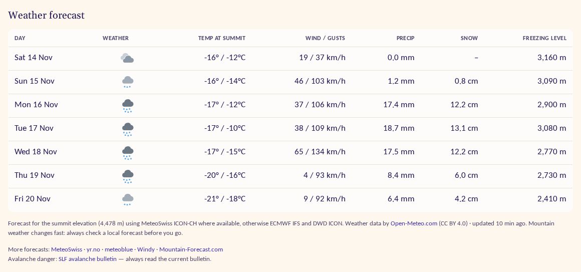
Every peak page now has a seven-day forecast taken at the summit's own elevation, from Open-Meteo. It uses the best regional weather model for that part of the world (MeteoSwiss ICON-CH over the Alps, for example) and a global one where there is none, so Japanese peaks get forecasts too. Each day shows the weather as an icon with a description on hover, temperature at the summit, wind and gusts, precipitation, snow and the freezing level. Days are labelled by the peak's local date.
When the summit is below freezing, rain is shown as snow with an estimated amount, because that is what you will meet up there. Under the table are links to other forecasts and, where there is one, the regional avalanche bulletin, with a plain reminder to read it. For researched peaks there is a deep link to Mountain-Forecast, added only after checking the page matches the peak by position and elevation. Forecasts are cached for two hours.
Compare peaks side by side
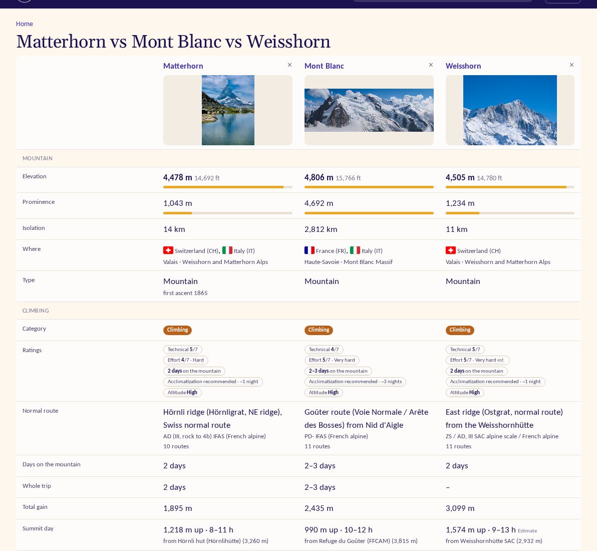
A new compare page puts up to three peaks next to each other: photo, elevation and prominence with bars, isolation, where it is, type and first ascent, then the climbing side: category, the three ratings, the normal route and its grade, days on the mountain, total gain and the summit day. Each peak page has a "Compare with…" box where you type any peak, and suggests sensible partners: the nearest higher peak within about 500 km, a similar climbing peak, or one from the same list.
The people in a mountain's history
In the afternoon the people arrived. We imported notable climbers, mountaineers and skyrunners from Wikidata, with their names in every language merged into one profile, and linked them to our peaks by first ascent, by namesake and by where they died. Each peak page now has a "Climbers and history" section; the Matterhorn's starts with the 1865 party of Edward Whymper. A /people directory can be searched by any spelling, country or discipline, and every person has a profile with a timeline of their mountains and a short Wikipedia bio. Only climbers are listed.
Also
- Two new lists: country high points and US state high points, with border peaks counting for both sides.
- Tooltips explain how technical, effort, length, altitude, acclimatization and ranking scores are worked out; they open on hover, focus or tap.
- Approximate positions show a dashed uncertainty circle on the map.
- Data work in the background: 5,144 peak positions checked against other sources and 1,826 corrected; routes started arriving from Camptocamp (CC BY-SA) with attribution per route; research grew to cover the US 14ers, the Alpine 4000ers and the best-known peaks of every country and US state.