 My Dream Peaks
Day 4 · Saturday 7 November 2026
Heart-rate zones, training load and the oxygen on top
Climb pages learn heart-rate zones and training load, peak pages show how much oxygen is left on the summit, and every climb gets a filterable list.
Day four was about what a watch track can tell you once a climb is logged: how hard it really was, how thin the air was on top, and how to find one climb among a hundred. In the evening the site also got Google sign-in and member invitations. Built, as every day, by Peter with Claude.
How hard was it?
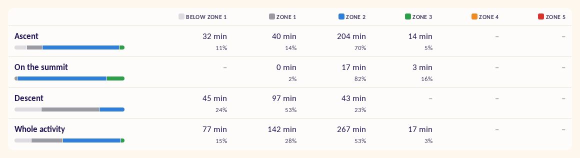
Every climb page with a heart-rate recording now draws one-minute heart-rate bars under the elevation profile, coloured by the member's own Garmin zones in the usual colours (gray, blue, green, orange, red), with a table of time and percent in each zone for the ascent, the descent and the whole activity. You can see at a glance that a long descent was mostly zone 1 while the climb sat in zone 2.
On top of that sits training load: Banister and Edwards TRIMP, plus Garmin's own training load and aerobic effect, split between the way up and the way down. Because Banister's formula differs for women and men (Morton et al. 1990), members can set an optional, private sex in their profile. By lunchtime the analysis added two altitude-aware numbers: aTRIMP, which scores effort against the maximum heart rate you can actually reach at that height (Mourot 2018), and hypoxic dose in km·h. Each has a mouse-over explanation.
Oxygen on the summit
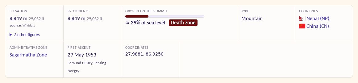
Peak pages now show how much oxygen is left on top compared with sea level, using West's model atmosphere (1996) adjusted for latitude and the climbing season. A meter and a label shade from green to dark red as you approach the death zone; on Everest it reads about 29% of sea level. A tooltip gives the air pressure and what it is like to breathe there.
A climbs list that scales
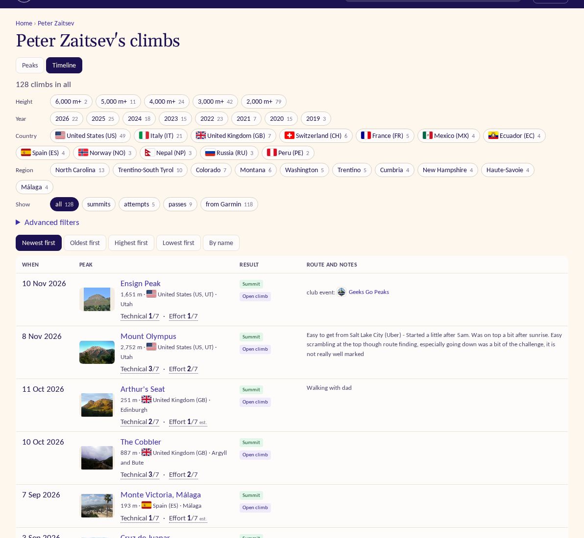
A profile now shows your 25 highest peaks (each once, ×N when repeated) or your 25 latest climbs, and links to a full
list at /u/<handle>/climbs. Quick chips filter it by height band, year, country, region and result, with sorting and
paging. Repeat peaks show summit and attempt counts, and the profile's Summits, Attempts and Passes counts open the
list already filtered. Each climb can also get a private 1–5 star rating, and a peak page has a "You summited it" card
with every one of your climbs there.
Smarter Garmin finds
Real tracks are messy. Detection now trusts a precise summit point over watch altitude drift, never credits a peak the track passes 300 m or more above, and smooths altitude that jumps back and forth. Where a track's altitude is still mixed up, the page says "altitude invalid" plainly and shows only the net climb. On the import page you can mark a track's GPS as wrong, review possible attempts on big peaks you were heading for, preview a track before answering, and leave resort skiing hidden by default.
Also
- Sign in or register with Google.
- Member invitations by email, community guidelines, and all site emails in one house design; a connection request can be accepted with one tap from the email.
- Sitemaps and link previews for search engines and social networks.
- Research continued on climbers and on peaks members had climbed, starred or listed.