 My Dream Peaks
Village
Le Peuty
1,326 m · Valais · Switzerland
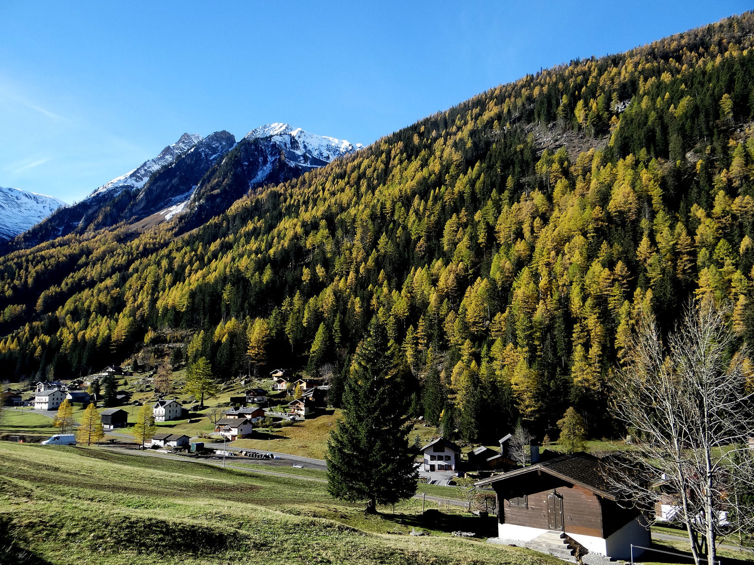
A hamlet at the southern end of Trient in the Swiss Valais, at the foot of the climb to the Col de Balme and across the meadows from the village's pink church. On the Tour du Mont Blanc it is the usual overnight between the Col de la Forclaz and the Col de Balme, with a small refuge and a communal walkers' rest area; the Trient glacier comes into view up the valley. In spring it is also a start for ski tours.
Staffed in season · June to early October (Refuge Le Peuty from 4 June in 2027); communal rest area 1 June – 1 October · 19 beds
History and people
- 1900 Trient, with its hamlets, became a commune of its own, separating from Martigny-Combe. ↗
Good to know
- In the second half of the 19th century Trient lived partly from cutting ice on the Trient glacier. ↗
- The Refuge Le Peuty has a dormitory and a Mongolian yurt, where dinner is served; its hosts are trained outdoor guides. ↗
- The commune's free walkers' rest area at Le Peuty takes no bookings (first come, first served); its listing says the pitches by the stand and the shelter are currently closed because of rockfall risk. ↗
Getting there and climbing from here
- From Col de la Forclaz (1,526 m) · Tour du Mont Blanc down to Trient and along the valley floor to Le Peuty
- From Col de Balme (2,191 m) · Tour du Mont Blanc in reverse, down through the forest
- From Martigny · PostBus over the Col de la Forclaz to Trient; in summer some buses go on to Châtelard
Staying: Refuge Le Peuty (19 places, half board) books through the official Tour du Mont Blanc booking site or by email/phone; the communal rest area (Place de repos du Peuty) is first come, first served. The Auberge Mont-Blanc in Trient village is a short walk away. ↗
Peaks it serves
- Fenetre d'Arpette 2,665 m · routes start here
- Génépi 2,884 m · 4.6 km away
- Pointe Ronde 2,655 m · 2.1 km away
- Croix de Fer 2,343 m · 1.8 km away
- Tête de Balme 2,321 m · 2.7 km away
- Mont de l'Arpille 2,085 m · 3.6 km away
Treks
Tour du Mont Blanc, anticlockwise from Les Houches stop 26 of 31
Les Houches → Les Contamines-Montjoie → Notre-Dame de la Gorge → Refuge de Nant Borrant → Refuge de la Balme → Refuge de la Croix du Bonhomme → Les Chapieux → La Ville des Glaciers → Refuge des Mottets → Rifugio Elisabetta Soldini → Refuge de Combal → Rifugio Maison Vieille → Courmayeur → Rifugio Giorgio Bertone → Rifugio Walter Bonatti → Rifugio Elena → Alpage de la Peule → Ferret → La Fouly → Praz de Fort → Issert → Champex-Lac → Plan de l'Au → Col de la Forclaz (Valais) → Trient → Le Peuty → Refuge du Col de Balme → Tré-le-Champ → Refuge de la Flégère → Planpraz → Refuge de Bellachat
Routes
- Fenetre d'Arpette: Trient (Le Peuty) to Champex (clockwise TMB) starts here · T4
Weather forecast
Loading forecast…
More forecasts: MeteoSwiss · yr.no · meteoblue · Windy · Mountain-Forecast.com
Map
Nearby: Trient village · 1,280 m · 1.3 km · L'Auberge du Mont Blanc lodge · 1,290 m · 1.3 km · Col de la Forclaz (Valais) trailhead · 1,526 m · 1.4 km · Alpine Hut Herbagères hut · 2,040 m · 2.3 km · Chalet des Grands hut · 2,113 m · 2.7 km · Cabane des Grands hut · 2,113 m · 2.8 km · Refuge du Col de Balme hut · 2,206 m · 2.9 km · Le Châtelard - Tête Noire trailhead · 1,199 m · 3.1 km
Links
Sources
Researched 2026-11-13 (medium confidence) from: www.camptocamp.org/waypoints/104512 · montourdumontblanc.com/en/refuges/refuge-le-peuty · www.autourdumontblanc.com/en/accomodations/li... · www.autourdumontblanc.com/en/accomodations/li... · www.autourdumontblanc.com/en/accomodations/li... · www.autourdumontblanc.com/en/routes/all-route... · www.refuges.info/point/7103/gite-d-etape/refu... · en.wikipedia.org/wiki/Trient,_Switzerland · de.wikipedia.org/wiki/Trient_VS · www.geonames.org/11218627 · api3.geo.admin.ch/rest/services/api/SearchSer... · trient.ch/ · www.camptocamp.org/images/472394
- www.autourdumontblanc.com/en/routes/all-routes/tour-du-mont-blanc
- en.wikivoyage.org/wiki/Tour_du_Mont_Blanc
Camptocamp (CC BY-SA)