 My Dream Peaks
Day 12 · Sunday 15 November 2026
Country pages, you in a country, and rivers on your tracks
Countries, regions, ranges and continents become profile pages with their own lists; each member gets a shareable page per country; tracks name the rivers crossed.
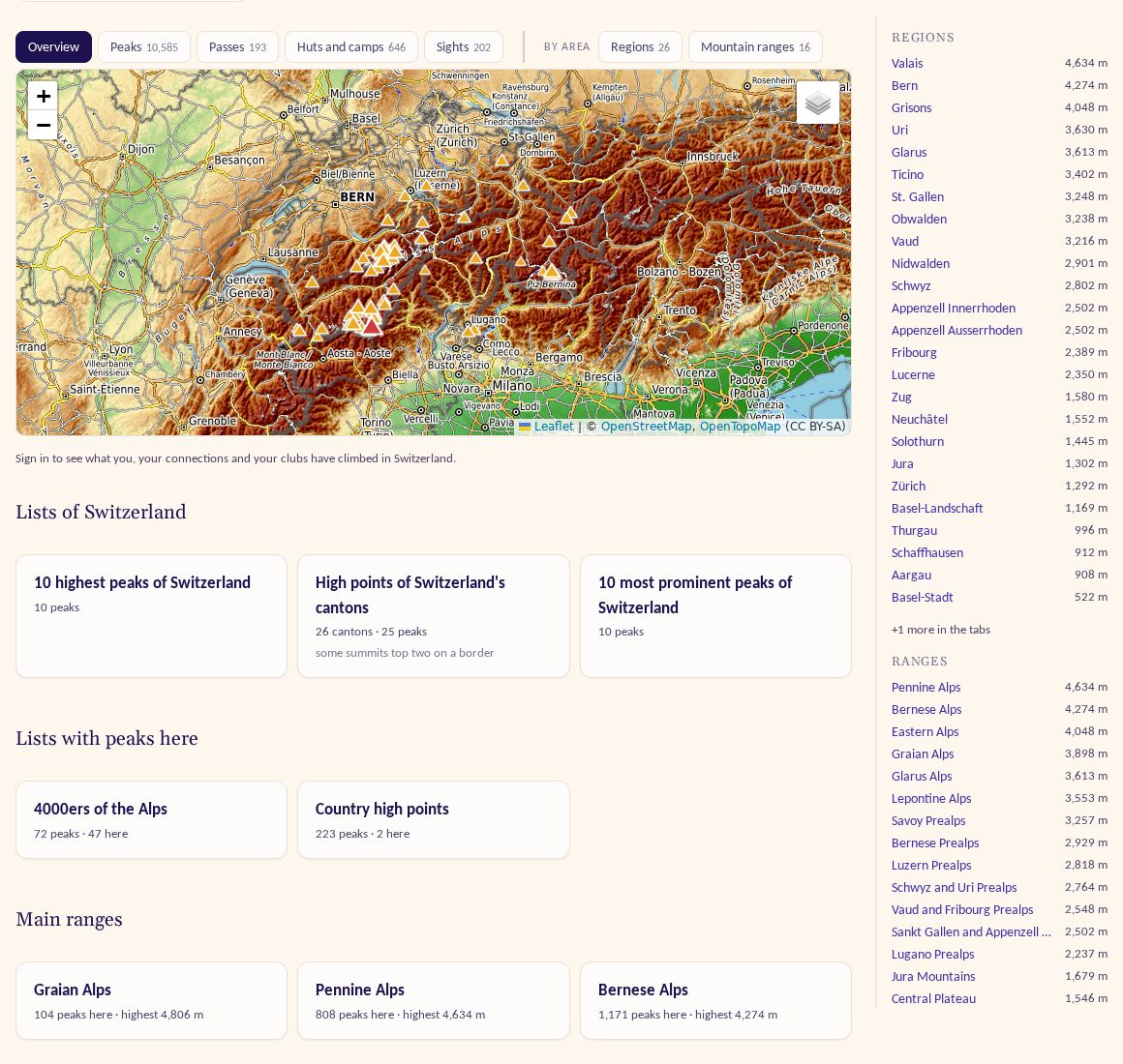
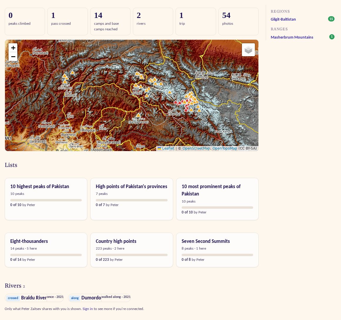
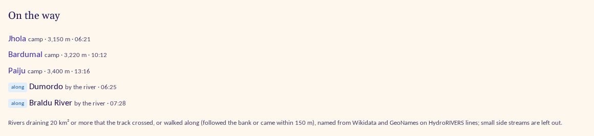
Day twelve was about places on a bigger scale. Until now a country was mostly a long table of peaks. By the evening countries, regions, mountain ranges and continents had become real profile pages with lists of their own, every member had a page for their story in each of them, and tracks had learned to name the rivers they met. It was a long day.
Country, region, range and continent pages
Open Switzerland and you land on an Overview: a map of its best-known peaks with the highest in red, the lists that belong to the country, and a side panel of its regions and ranges with their heights. Tabs come in two groups: what is there (Overview, Peaks, Passes, Huts and camps, Sights) and by area (Regions, Mountain ranges). Continents, ranges and regions share one template, so they all behave the same way.
The lists are new. Every country now gets its 10 highest and 10 most prominent independent peaks, the high point of each region (cantons, states, provinces), and its highest volcanoes where it has five or more. Regions with 30 or more independent peaks get their own top 10s. Each list page says how it was made, and the Lists page got a search box that finds any of them by name, country or region (try "Wales"). A peak with a doubtful height can no longer be the highest of anything (a Norwegian hill had been entered as 3,322 m instead of 332 m), and overseas territories count as their own places, not as the UK or France. Search finds countries, states and continents too, as a card at the top of the results.
Bigger regions come first. The United Kingdom now opens on England, Scotland, Wales and Northern Ireland instead of 232 counties, and Italy, France and Spain on their regions; each has its own page with its smaller areas inside. So there is a list of the UK's nations' high points: Ben Nevis, Snowdon, Scafell Pike and Slieve Donard.
You and a country
Signed in, each of these pages also shows what you, your connections and your clubs have done there. The details sit
on one page per member and place, such as /country/pk/u/peter-zaitsev: tiles for peaks climbed, passes crossed,
huts, camps and sights reached, rivers and trips; a strip of photos; progress on every list with peaks there; and the
best-known peaks marked climbed, attempted or not yet. On someone else's page a "You vs them" box compares the two of you.
These pages are made to be shared. Anyone can open the link and sees only what that member already shares with them. On side panels, the regions and ranges where you have been get a small green count, so you don't have to click through them one by one.
Rivers and sights on your tracks
A track's "On the way" section now lists the rivers you crossed or walked along, with blue markers on the map: rivers draining 20 km² or more, named from Wikidata and GeoNames. The first version turned a day up a valley into a dozen "crossings", so now a river you followed counts once, as "along".
Sights became their own family of places: waterfalls and viewpoints, plus glaciers, natural arches, show caves, volcanic craters and mountain lakes from Wikidata, only those with a real Wikipedia article. Your timeline shows the sights your tracks reached, with their own filter chip.
Also
- Every map got a Satellite layer. Map popups show country, range and the Technical and Effort ratings, and a crosshair in peak, hut and sight tables highlights that item on the map.
- Peak tables sort by prominence and isolation.
- Statistics with no single number show as estimates with an asterisk; Mont Blanc's deaths per year now appear.
- Place pages tell you when one of your tracks passed by; unplaced photos can go onto a day all at once.
- Research: 82 waterfalls and viewpoints, 240 peaks on famous lists (Japanese, Korean, Adirondack, Bulgarian…), 150 huts and camps, 200 climbers and statistics for 40 well-known peaks, all with local-language sources.