 My Dream Peaks
Day 13 · Monday 16 November 2026
Your progress on a list, one peak card on every map, share images for places
A member's progress on a list becomes the list page itself, with a map and peak photos; every map opens the same peak card; countries and regions get share images.
Day thirteen was about making things look and behave the same wherever you meet them. A list looked one way on its own page and another way as your progress; a peak's card on a trip map said less than on a country map; and a country page shared on a chat app showed only our logo. The rest of the day went into making the bigger pages quick.
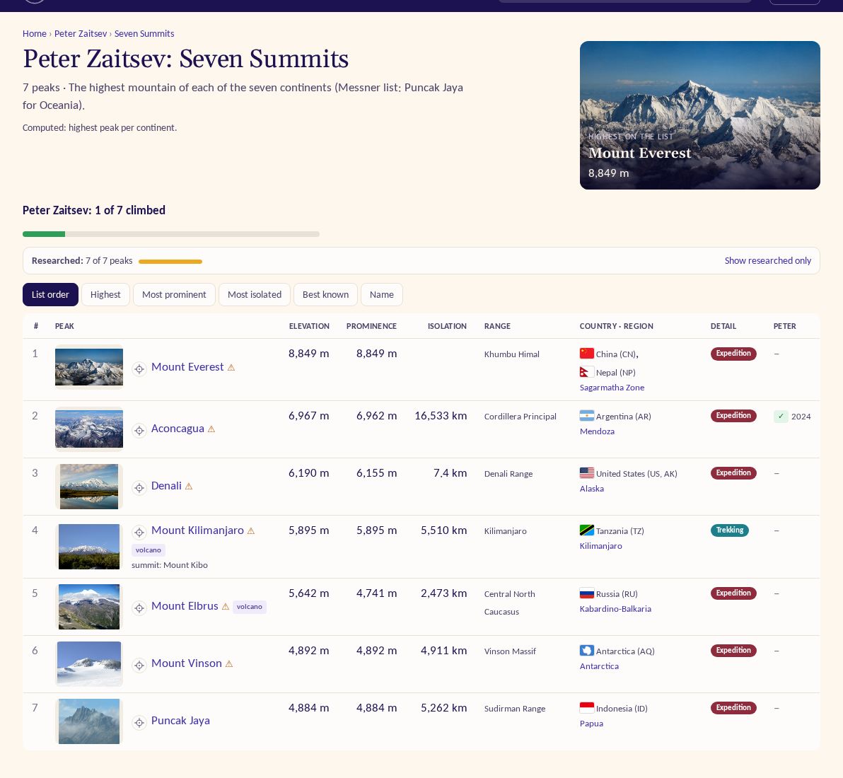
Your progress on a list is the list page
Until now, a member's progress on a list was a page of its own. Peter wanted it "consistently similar to this page but
just for specific climber", so now it is exactly that. /u/peter-zaitsev/progress/seven-summits is the Seven Summits
page shown for Peter: the same header and photo, a bar with "1 of 7 climbed" (and how many attempted), the map with his
summits in green, and the same table, with the year of each climb. Anyone can open it, and it shows only the climbs
that member already shares with you. If you are signed in and looking at someone else's progress, a link takes you to
yours.
Every list table also got a small photo of each peak, so a long list is easier to scan. The maps on list pages learned to zoom out properly when a list spans continents: the Seven Summits now show the whole world, on a taller map for lists that run from pole to pole.
One peak card on every map
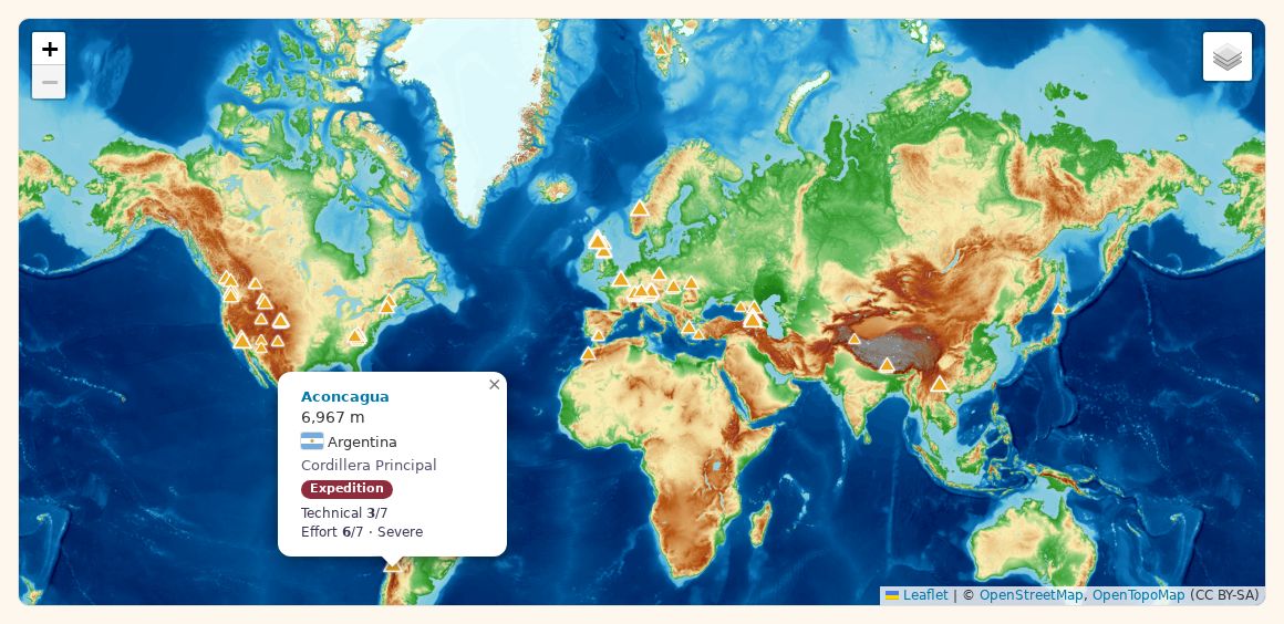
On day twelve the map popups on country and list pages got a proper card: the peak's height, its country with a flag, its range and, for researched peaks, its category and the normal route's Technical and Effort ratings. Other maps, like the one on a profile, a trip or a track, still showed just a name and height, because their points were sent without those details.
Now every map uses the same small script for the card. When a map's points come without the details, the card asks for them the first time you click a peak and fills itself in. So the summits on your trip map, the peaks on a profile and a country map all open the same card, and our help pages say so.
Share images for countries, regions and you there
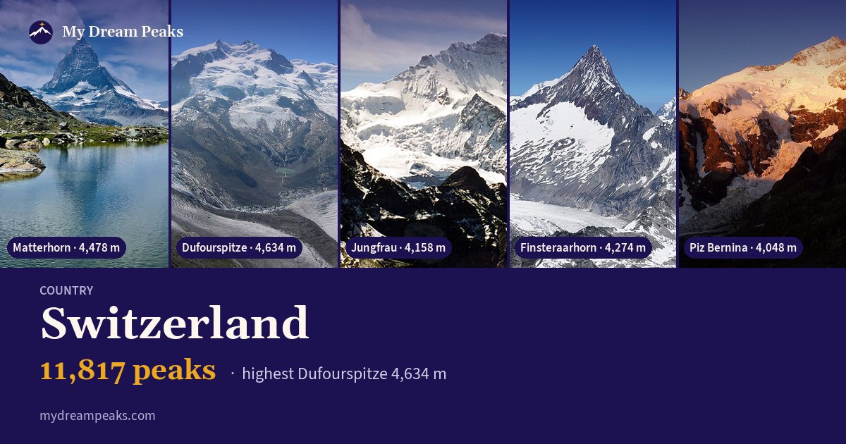
When you share a link, the chat app shows a preview picture. Peaks, lists and climbs already had their own; countries, regions, ranges and continents still showed the plain logo. Now they get a picture in the style of the famous lists: photos of the area's best-known peaks on top, and below its name, how many peaks it has and the highest. Regions are labelled with their own kind, such as Nation or State.
A member's page for an area, like Peter and Pakistan, gets one too: their photo and name, how many peaks they climbed there and photos of those summits, built only from what anyone may see. A member's other pages (their tracks, trips, photos) now use their profile image, and the few pages left without a picture of their own show a collage from the home page instead of the logo.
Also
- Prominence and isolation figures now also come from the infoboxes of local-language Wikipedia, and from published figures our research finds, after Wikidata and English Wikipedia; a few impossible values were cleared, and peaks such as Etna and Mauna Kea got theirs back.
- Svalbard, Jan Mayen and Bouvet Island are now places of their own instead of part of Norway.
- The heaviest country, region and continent pages are now prepared overnight, so they open quickly; maps and track pages got faster too.
- A security review and fixes, and a CDN in front of the site so pages load faster.
- Research: 108 member peaks, 192 climbers, 32 huts and camps, and statistics for 40 more famous peaks.