 My Dream Peaks
Your climbs and trips
Tracks and canyon descents
Every GPS recording is a track: where it went, the parts of the day, what you passed on the way — and descents, the days that went down first.
A track is one GPS recording — a hike, a climb, a run, a ski tour — usually brought in from Garmin. Not every track reaches a summit, and that's fine: a track is the true record of the day, and the site shows only what it recorded. It never guesses places you didn't pass.
You'll find your tracks on your profile → Tracks: one row per activity, with the peaks it reached. Sort them by Newest, Hardest, Most gain, Highest top or Highest start; show all, only summits or attempts, or only days that topped out above 2,000, 3,000, 4,000 or 5,000 m.
Track names
Every track gets a name from where it went, so you can tell your days apart at a glance:
| The track… | Its name |
|---|---|
| went from one place to another | Khoburtse to Urdukas |
| reached a summit | Mount Kazbek from Bethlemi Hut |
| went from A to B over a summit or pass | Gorak Shep to Lobuche over Kala Patthar |
| went down a canyon and back | Down to Colorado River from Grand Canyon Village |
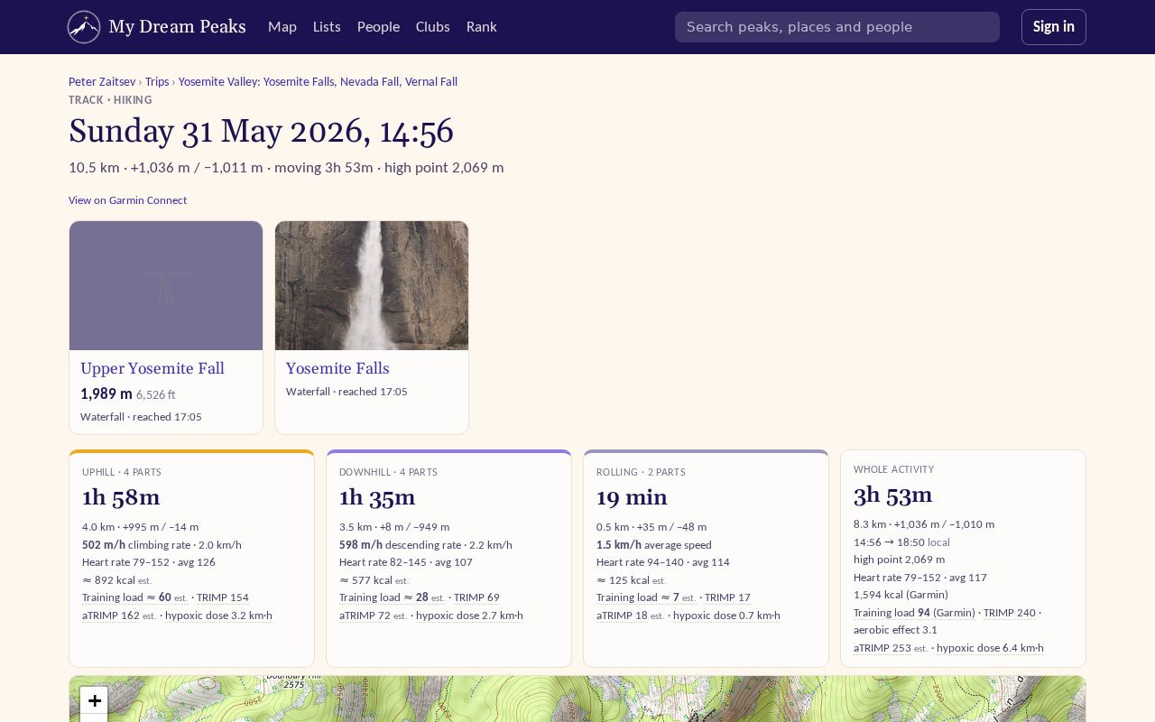
| went to a hut, waterfall or viewpoint and back | Upper Yosemite Fall from Yosemite Valley |
| none of these | Hike from Colfosco |
The name is the title of the track's page, and it's how the track is listed on your trip's days and shown with photos taken on it. To give a track your own name, open it and press ✎ Rename; leave the box empty to go back to the automatic name.
A track's page
- the map of the whole day, and elevation by distance and by time;
- On the way — the summits and passes you reached and the huts, camps and other places you passed, each a link; night marks where you slept (your choice in the day editor, else where the track ended and the next day's began); places you added by hand say added; glaciers are judged from their outline (RGI 7.0), like rivers: on the ice (with how far you went on it) or beside (within 100 m at the ice's height, not onto it); and the rivers — crossed (with how many times) or walked along (you followed the bank or came within 150 m without crossing); rivers draining 20 km² or more, named from Wikidata and GeoNames — small side streams and unnamed ones are left out — each with a blue marker on the map; A river's name opens its page: its course on the map, its catchment and average flow, and your own crossings of it.
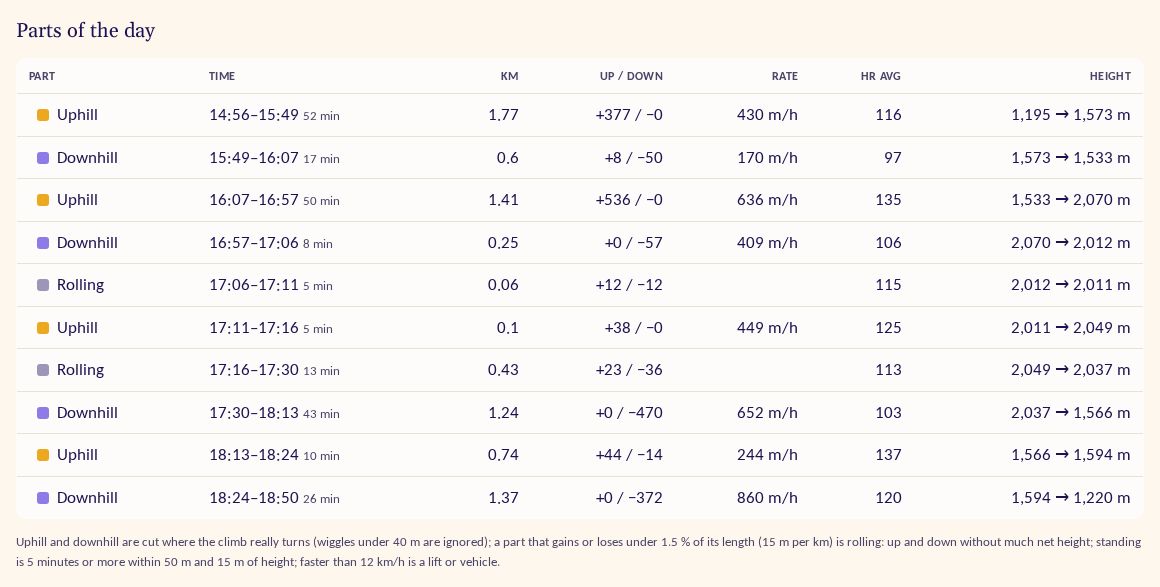
- Parts of the day — the day cut into uphill, downhill, rolling and stops, each with time, distance, height and pace;
- Time in heart-rate zones, calories and training load, if your watch recorded heart rate;
- the track's photos.
How the parts are cut: uphill and downhill split where the height profile really bends (by more than 20 m); a part climbing or descending slower than 40 m an hour, under 15 m in all or at less than 1.2 % is rolling; staying within 35 m for 10 minutes or more is standing; faster than 12 km/h, or more than 2,500 m of height an hour, is a lift or vehicle.
Where a track starts and ends
Each track is named by where it started and ended — a trailhead, a village, a hut. Places you start from often (home, work, the gym) are your usual spots: unless your profile is public, other members don't see their names. And whenever others look at your tracks, the 200 m around where each one started and ended is hidden.
Canyon descents
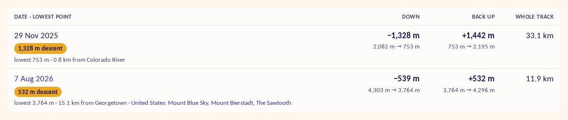
Some of the best days go down first: rim to river in the Grand Canyon, into a gorge and back out. When a track's lowest point is at least 500 m below both its start and its end, it's a descent. It shows:
- in your profile timeline, as its own row with the camps and the river passed on the way;
- on the track's page, with how far down you went, the lowest point and the climb back out;
- on your Tracks page, under Deepest descents.
Checked against the site on 18 November 2026 · All help pages · Questions: [email protected]